COLLECTION TRACKING:
Chicago’s 21st Street with Wally Abbey
By Scott Lothes
Chicago is the railroad hub of North America and the most-represented city in the archives of the Center for Railroad Photography & Art. We’ll likely return to the Windy City several times over the course of this blog; for this initial look, the focus is 21st Street Crossing and the photography of Wallace W. Abbey.
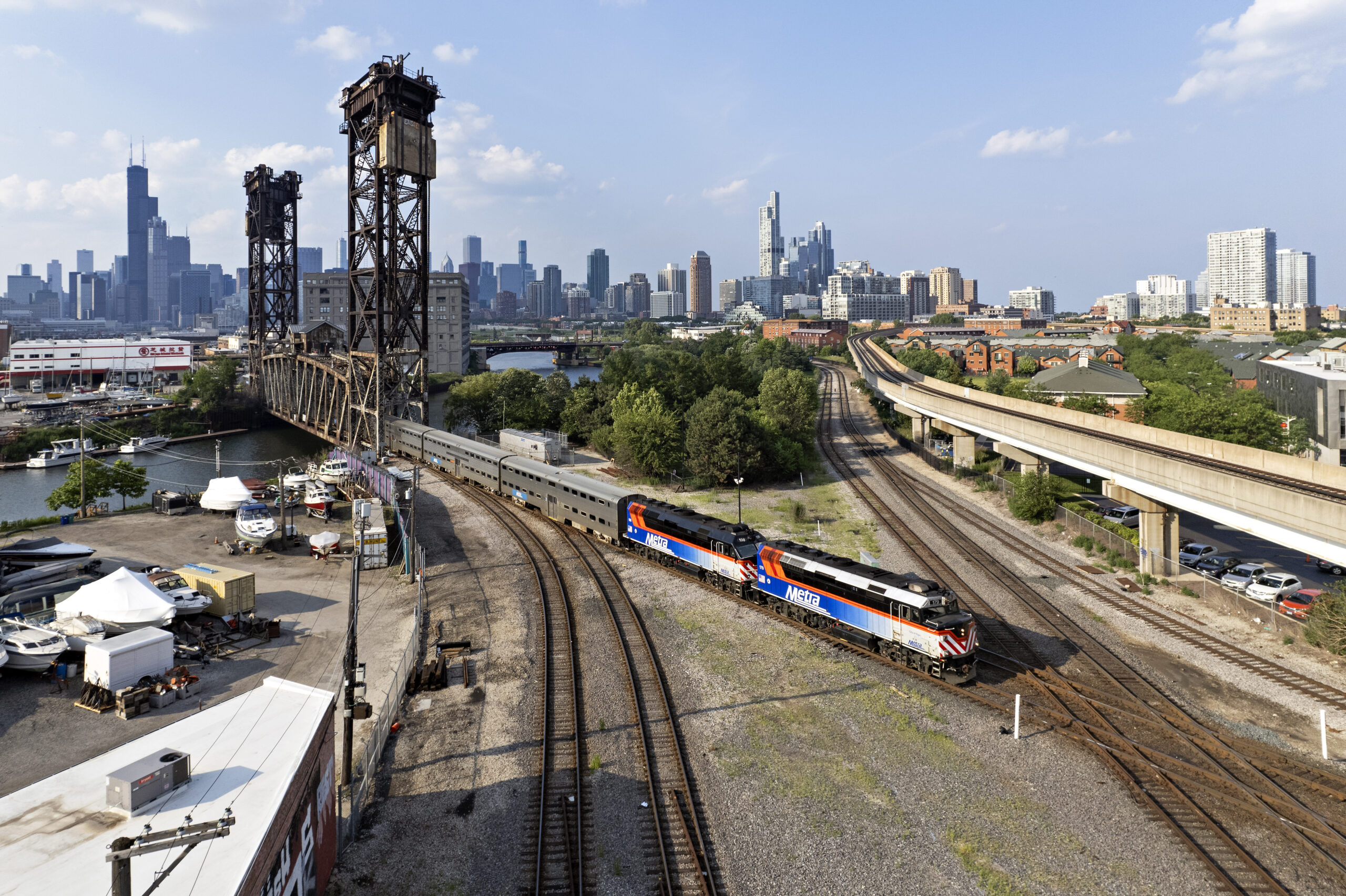
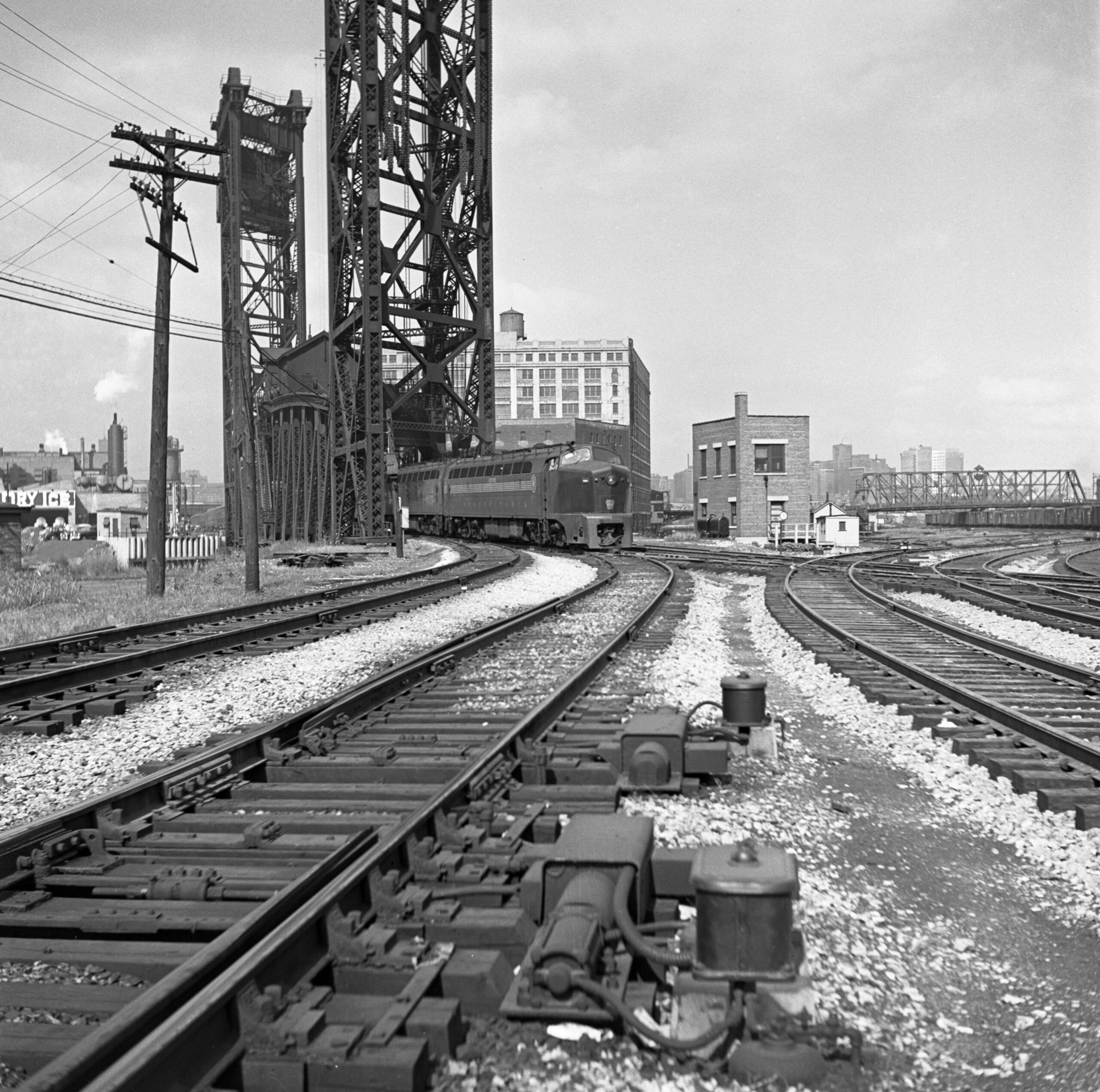
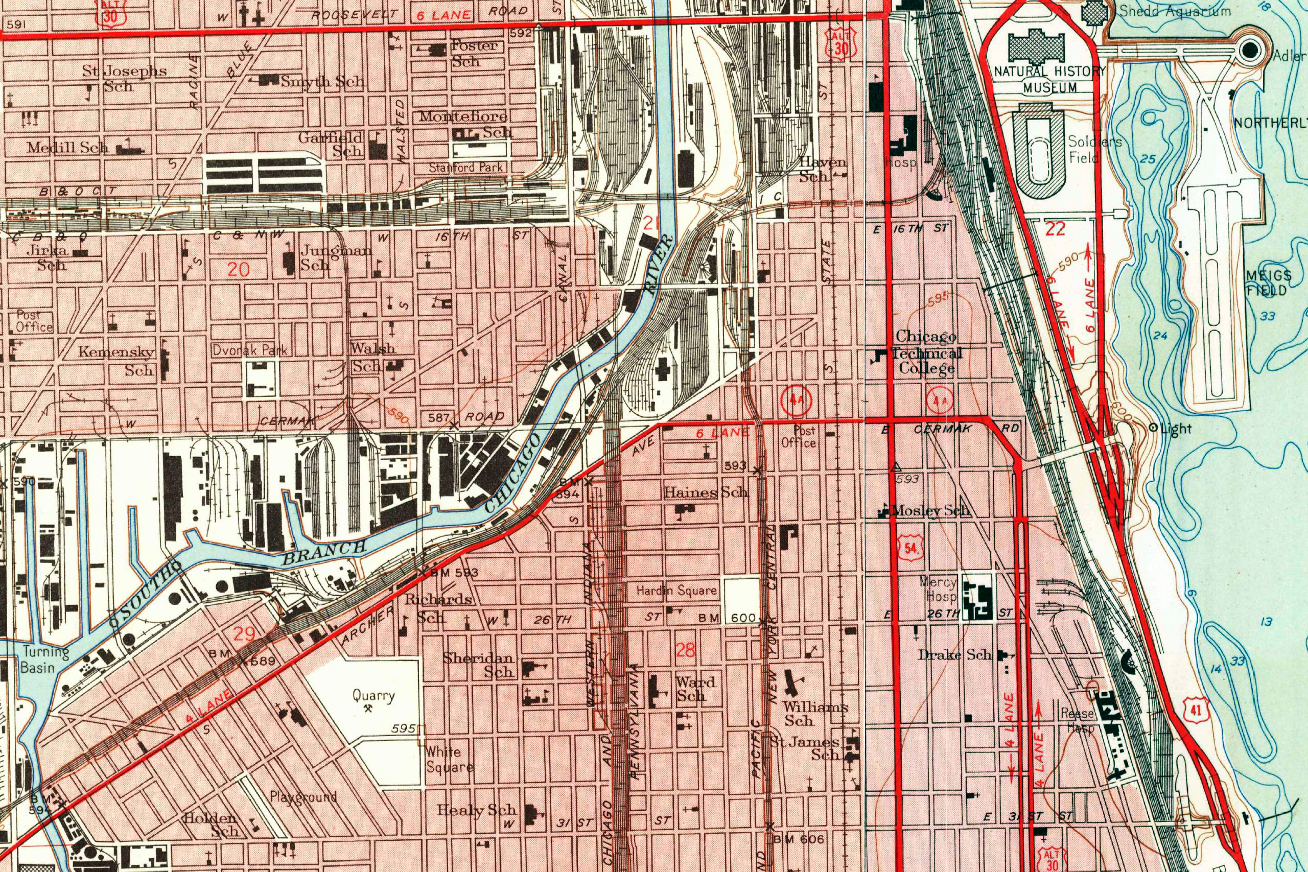
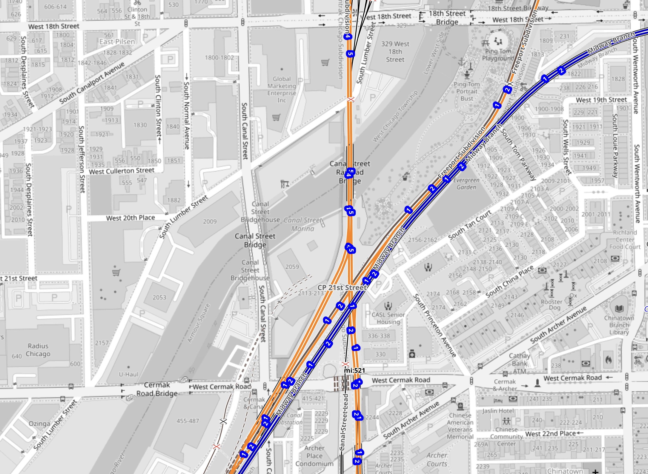
At its zenith, 21st Street—also called Alton Junction—involved five railroads and no fewer than 26 diamonds. They were located on the south bank of the South Branch of the Chicago River, a mile and a half south of Union Station. The Pennsylvania Railroad’s double-track main line crossed five curving lines of the Chicago & Western Indiana, and then all seven of those tracks crossed two more tracks, one each for the Illinois Central and the Santa Fe. In the northwestern quadrant of the crossing, the Chicago & Alton—Gulf, Mobile & Ohio after 1947—split off from the Pennsy to follow the IC and the Santa Fe to the southwest. Additional connecting tracks on the eastern side further complicated the mess. Immediately to the north of all this, Pennsy’s two-track Canal Street bridge crosses the river. The current structure features a lift span with 185-foot towers; it opened in 1914, replacing an earlier drawbridge with a swing span. C&WI operators controlled the complex interlocking plant out of a two-story, brick tower in the northeast quadrant of the intersecting tracks, next to the southeast corner of the bridge.
The tower
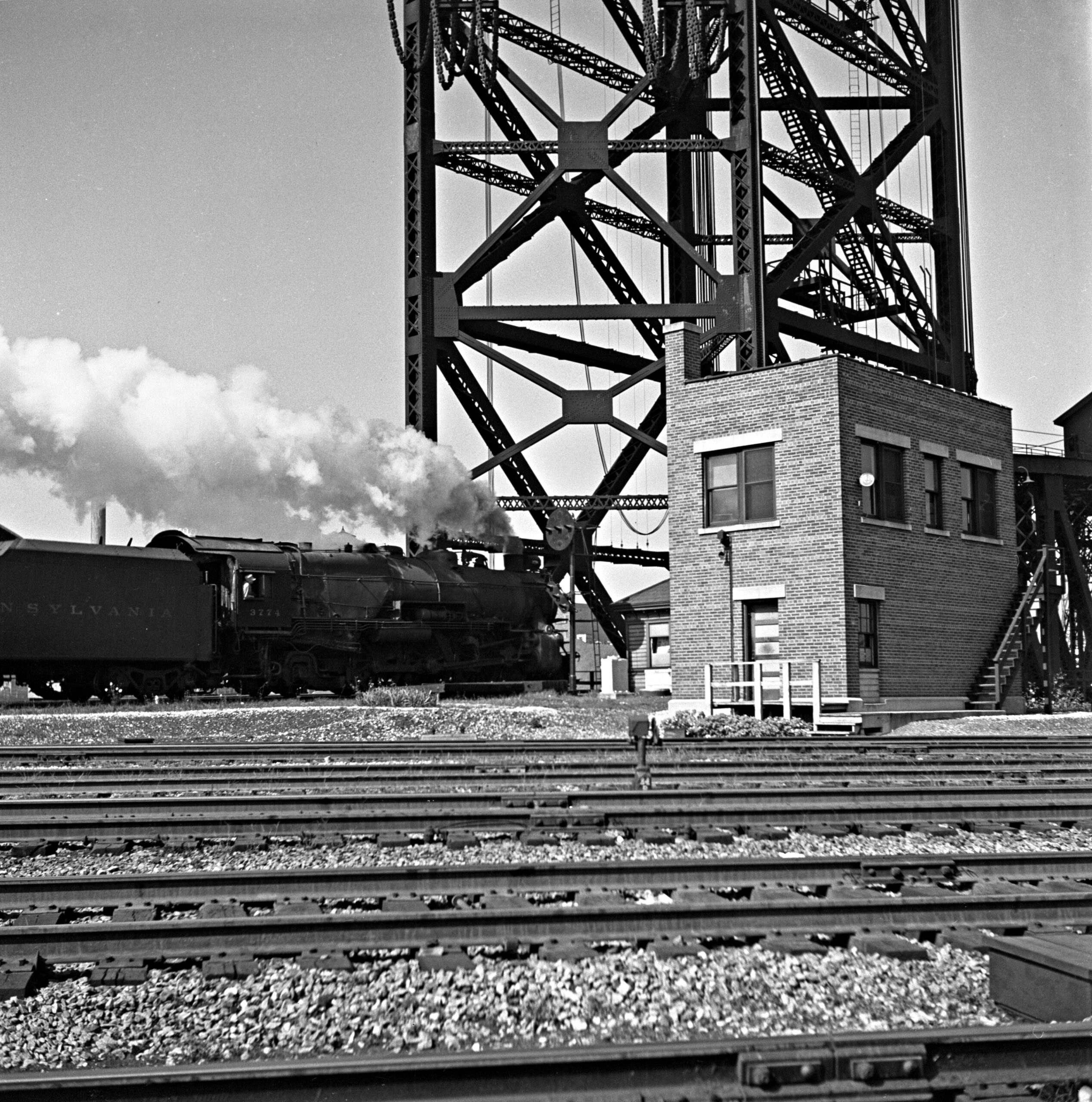
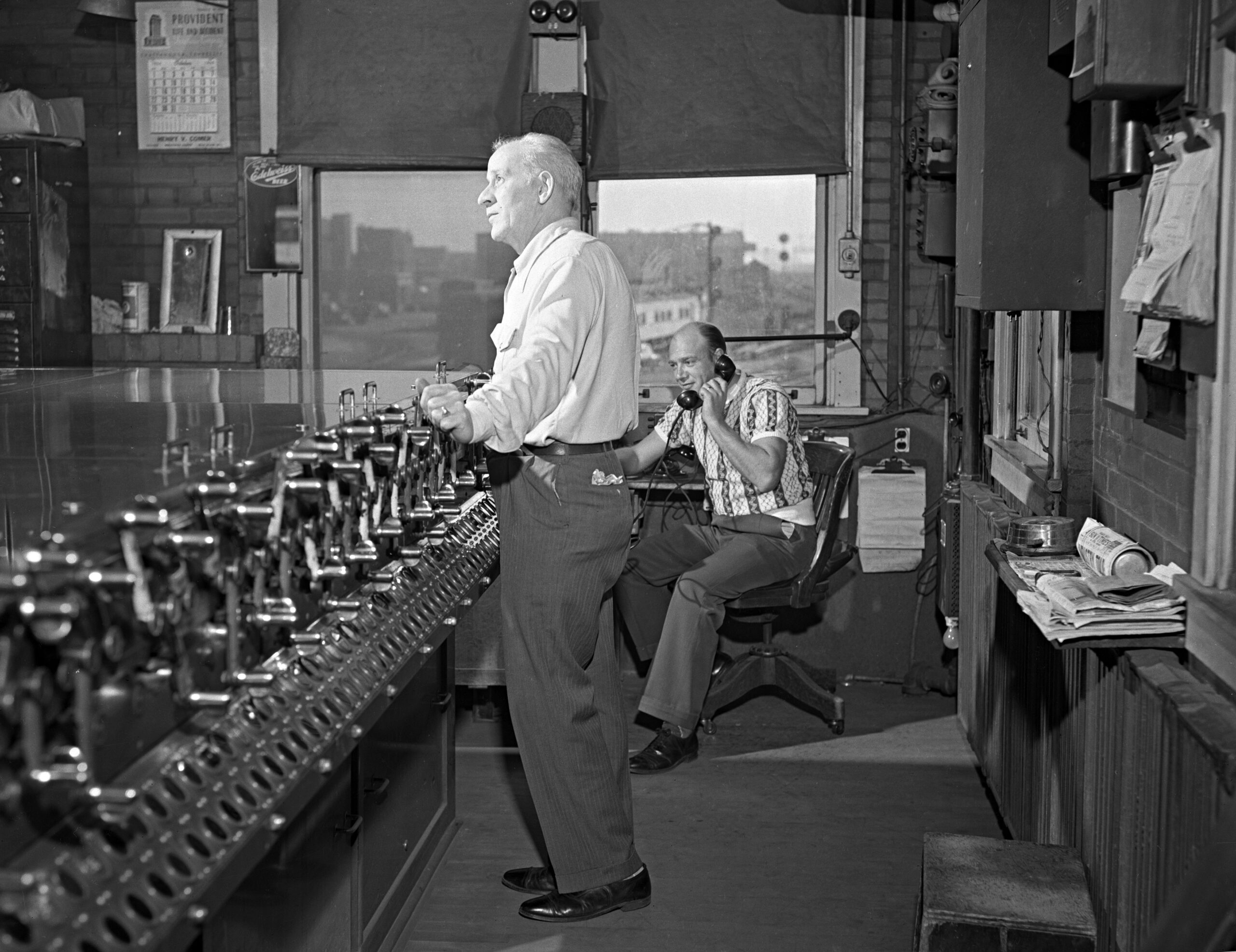
On assignment for Trains magazine, Abbey spent most of October 3 and 4, 1950, at 21st Street. He photographed many of the trains that passed for a photo essay titled “Nation’s Crossroads” in the December 1950 issue, highlighting the density of traffic: some 150 train movements every 24 hours. Passenger trains predominated, but there was also plenty of freight, with frequent transfer runs between various yards in the vicinity. Abbey recorded an incredible variety of motive power and rolling stock. While there was still some steam, diesels already held the edge, with cab units from EMD on many of the passenger assignments. There were also end-cab switchers and both cab and hood units from other manufacturers. Light engine moves were also common, with locomotives running between passenger stations to the east and terminal facilities to the west. Switchers pulled and pushed empty passenger trains in and out of the stations, and they even moved some through cars between stations for connections. On either side of the junction, rail-related infrastructure filled much of the land along the river.
1953 topographical map
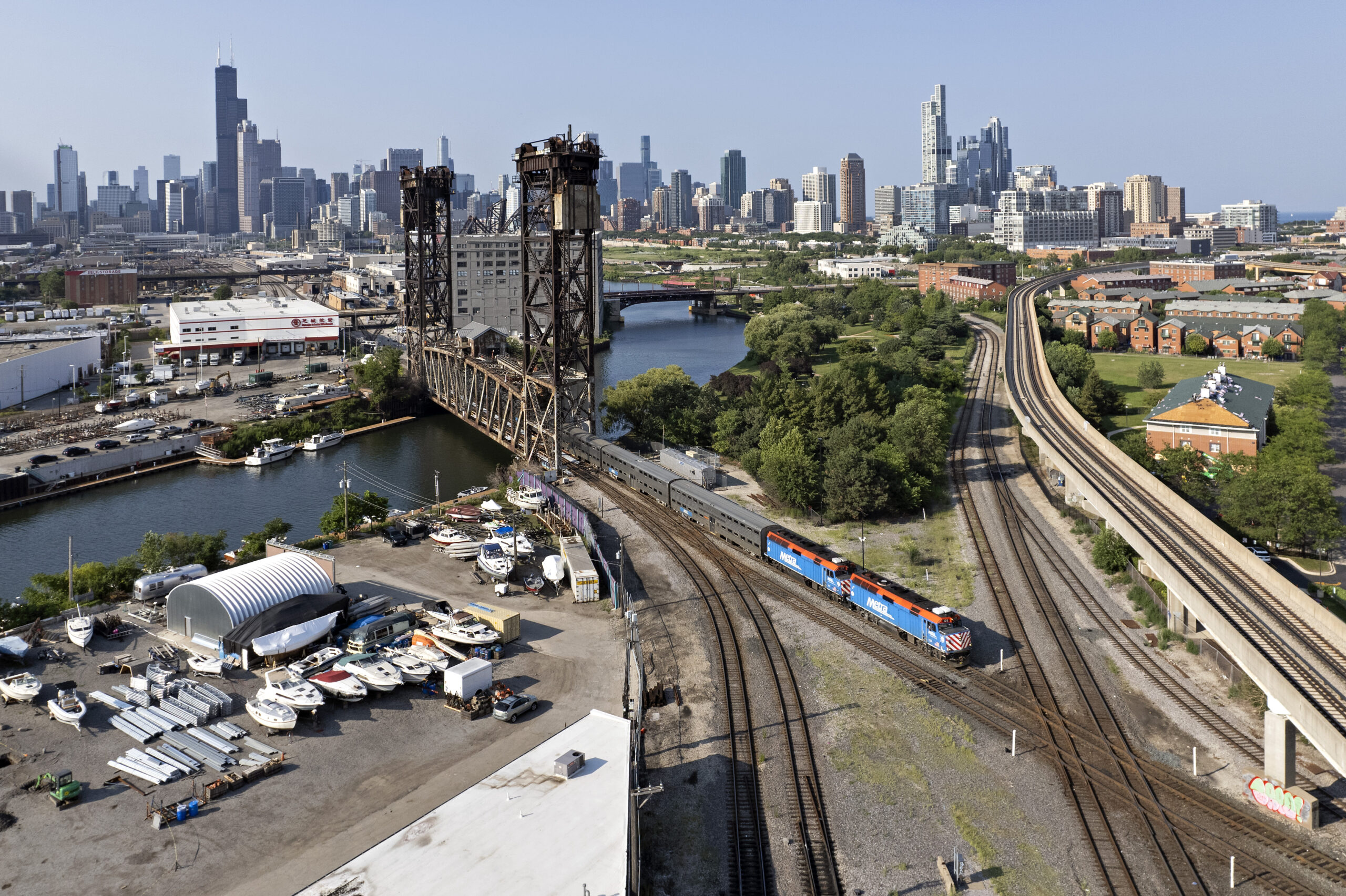
While 21st Street is still a busy junction in the 2020s, the crossing itself, the trains using it, and the land surrounding it have all changed greatly. The five curving tracks of the C&WI are gone; now the primary crossing is between two double-track lines, Norfolk Southern and Canadian National. The former used to be the Pennsylvania main line, while the latter was previously the Illinois Central and the Santa Fe. The former GM&O still veers off to the southwest, while Union Pacific has the one remaining ex-C&WI track running south. The one major addition is the Chicago Transit Authority’s elevated Orange Line, which soars over everything just south of the crossing, running parallel to the CN tracks.
The sprawling yards and engine terminal facilities that once clustered along the river are mostly gone. Immediately to the east of the NS tracks, recent developments of Chinatown occupy the former site of the Santa Fe coach yards, while Ping Tom Park has replaced the C&WI trackage as well as the Santa Fe engine facilities.
Passenger traffic is still heavy, consisting entirely of Amtrak and Metra service. Every Amtrak train running between Chicago and the East and South passes through 21st Street, about 40 trains every 24 hours. Metra’s Southwest Service and Heritage Corridor both run through 21st Street, totaling 36 trains on weekdays. Freight amounts to perhaps 8-12 trains daily and includes CN as well as handoffs between NS and BNSF.
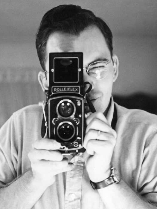
In addition to the many railroad-related changes, the experience of photographing trains at 21st is vastly different since Abbey was there in 1950. He enjoyed free reign to shoot from anywhere he wanted on the ground using his 2¼-square Rolleiflex camera. Legal access is impossible today for nearly every angle Abbey recorded; the southwestern corner of Ping Tom Park offers the only public viewpoint from the ground. But the advent of highly capable consumer drones has opened up a new world of possibilities for aerial photography, at least as long as federal regulations allow.
Let’s go back to 1950 and join Abbey at trackside on October 3rd and 4th. He exposed nearly 90 frames of black-and-white film on those two days, capturing much of the essence of 21st Street with its great volume and diversity of traffic. He stored his negatives out of sequence, likely due to the needs of the article—only the published photographs include details about the trains depicted. Based on sun angles and timetables, I’ve tried to reconstruct more information for some of what he saw, and I welcome additional thoughts and information. Drop me a line at scott [at] railphoto-art.org, and let me know if you have ideas for future installments of Collection Tracking.
Contemporary map
Timeline of selected train movements
Photographs by Wallace W. Abbey on October 3 and 4, 1950
8:00 a.m.
Pennsylvania steam
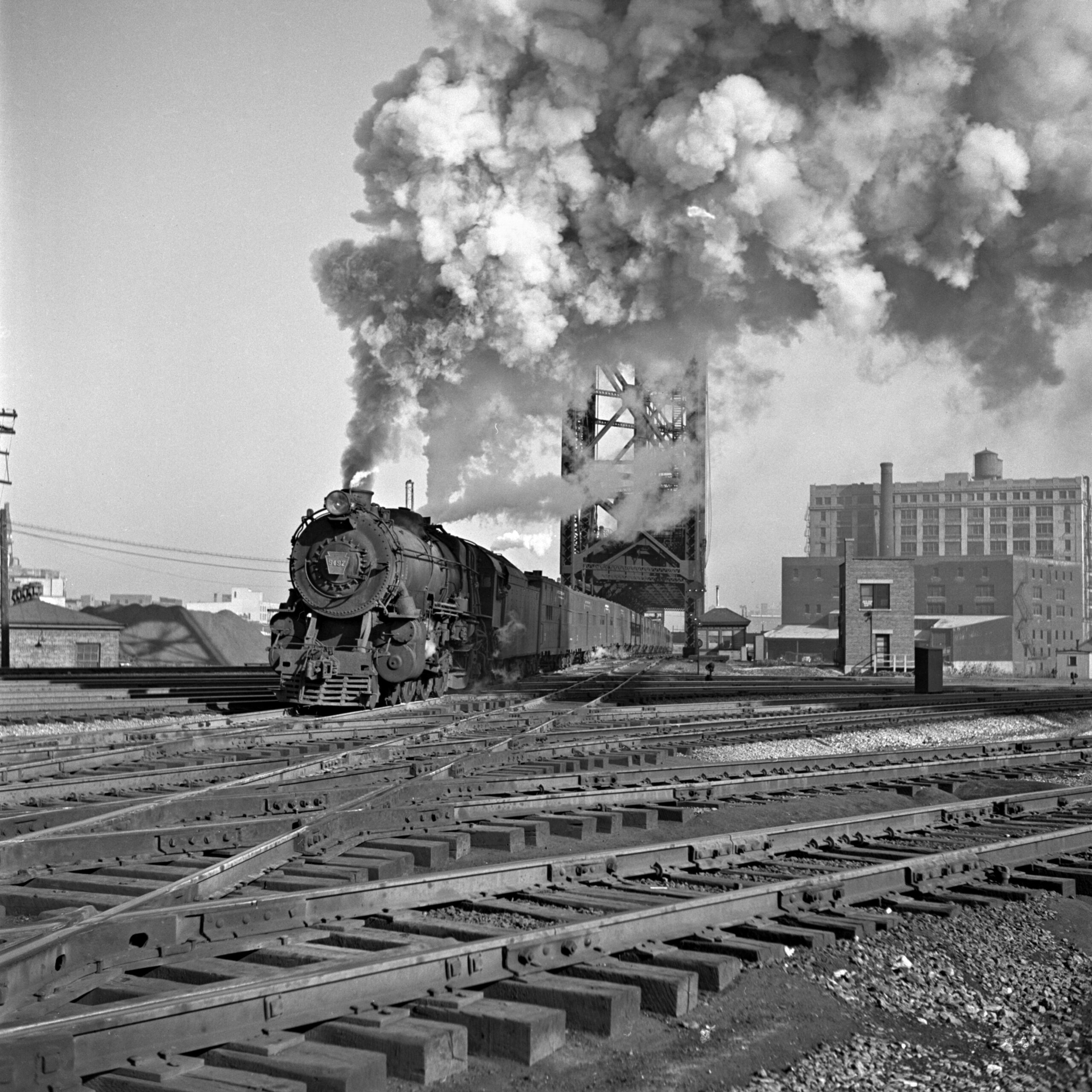
One of the Pennsylvania Railroad’s legendary K4-class 4-6-2 steam locomotives leads a train of empty passenger equipment out of Chicago Union Station and across the South Branch of the Chicago River. These engines had dominated Pennsy’s passenger trains just a few years earlier, but by the time of Abbey’s visit on October 3-4, 1950, they had become so rare that this was one of only two he photographed. Abbey-01-130-05
8:30 a.m.
Wabash steam and the Ann Rutledge
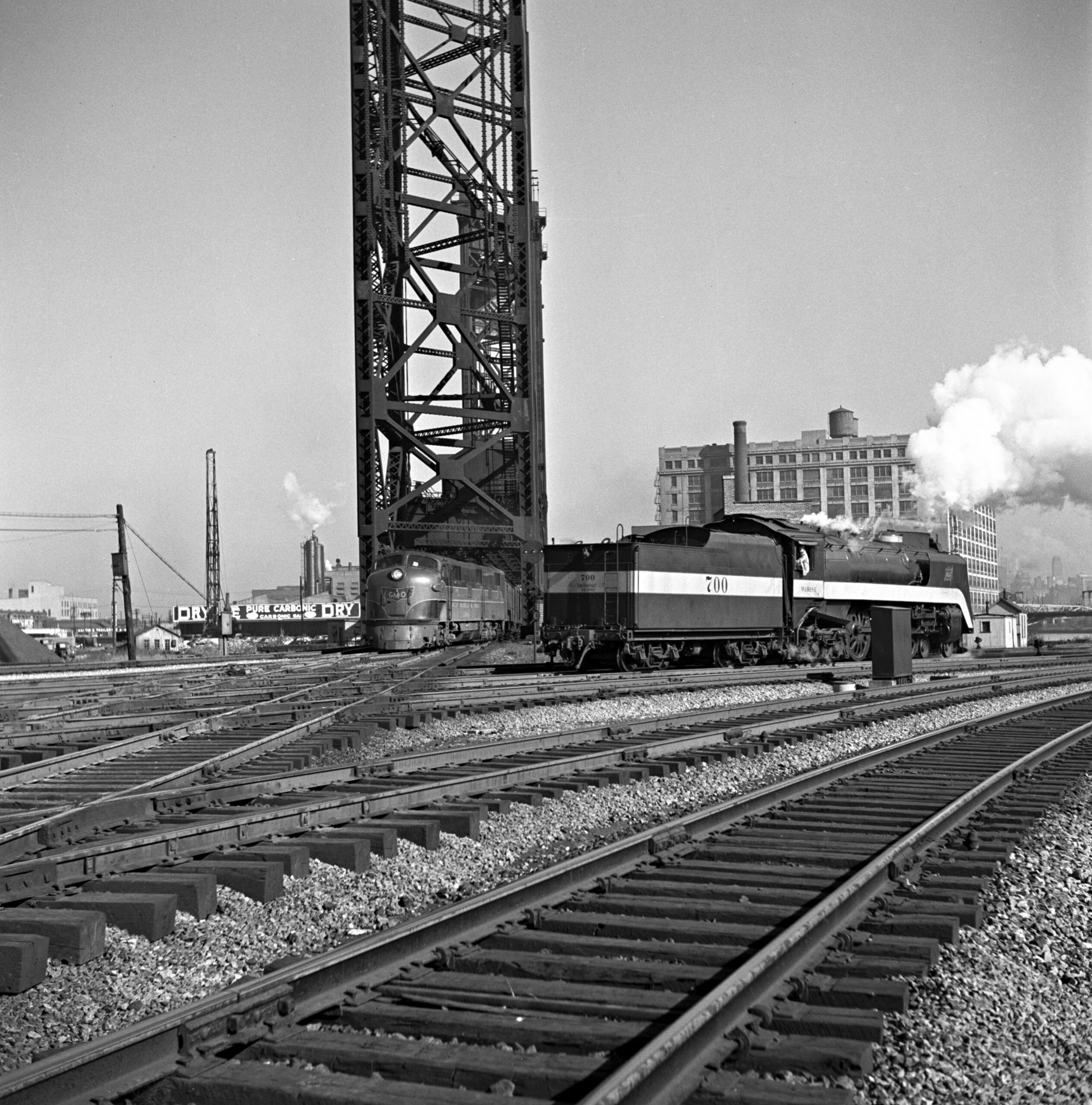
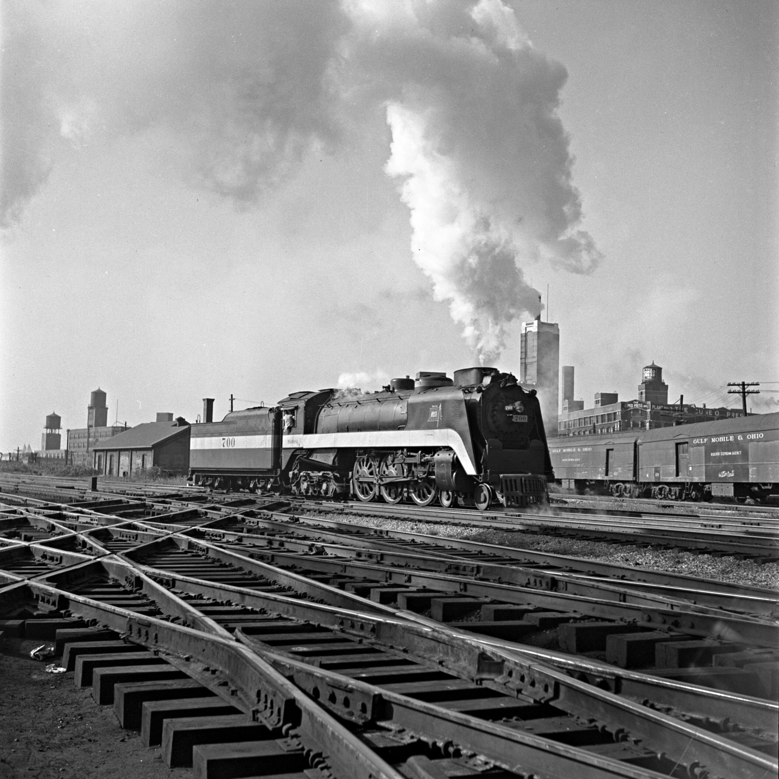
Gulf, Mobile & Ohio’s Ann Rutledge passenger train for St. Louis was due out of Chicago Union Station at 8:25 a.m. and crossed the river a few minutes later, just as Wabash 700 was backing through 21st Street. The 4-6-4 had brought an early morning local from Decatur, Illinois, into Dearborn Station, where it was due at 7:57. Abbey-01-130-007 and -010
8:35 a.m.
The Fort Pitt
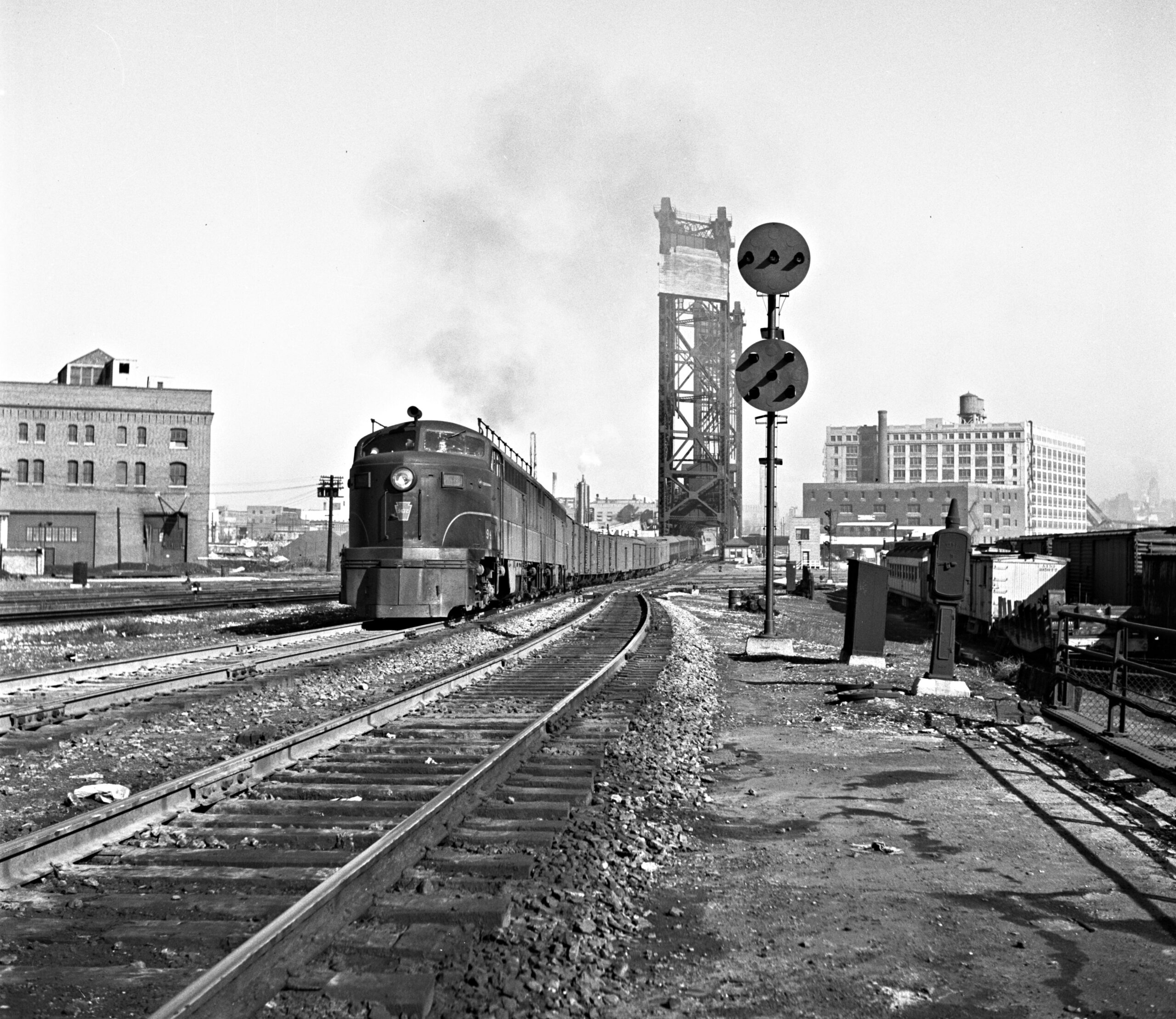
A few minutes later, a pair of Fairbanks-Morse “Erie-built” locomotives led Pennsy’s Fort Pitt through 21st Street for its all-day run to Pittsburgh, where it was due at 7:35 that evening. Abbey had just enough time to walk back from the diamonds to include the distinctive position-light signal. Abbey-01-128-007
8:50 a.m.
PA on a GM&O local
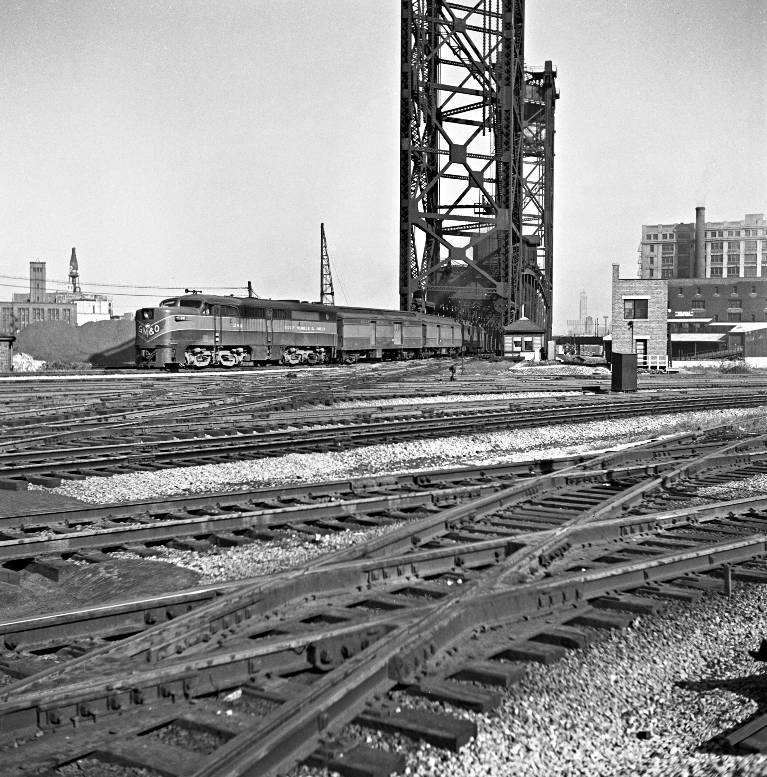
Gulf, Mobile & Ohio PA1 292 leads no. 11 across the bridge shortly after the train’s 8:45 a.m. departure from Union Station. The local would make as many as 50 stops on its way to St. Louis, where it was due at 7:05 in the evening—just a little earlier than the Pennsy’s Fort Pitt would arrive at Pittsburgh. Locomotive 292 was built in August 1947 for the American Locomotive Company for use on the first American Freedom Train, which traveled across the country from 1947 until 1949. Afterward, it was rebuilt by Alco and sold to the GM&O along with a brass plaque just below the cab explaining the locomotive’s significance. Abbey-01-126-004
8:55 a.m.
The Texas Chief meets a cab hop
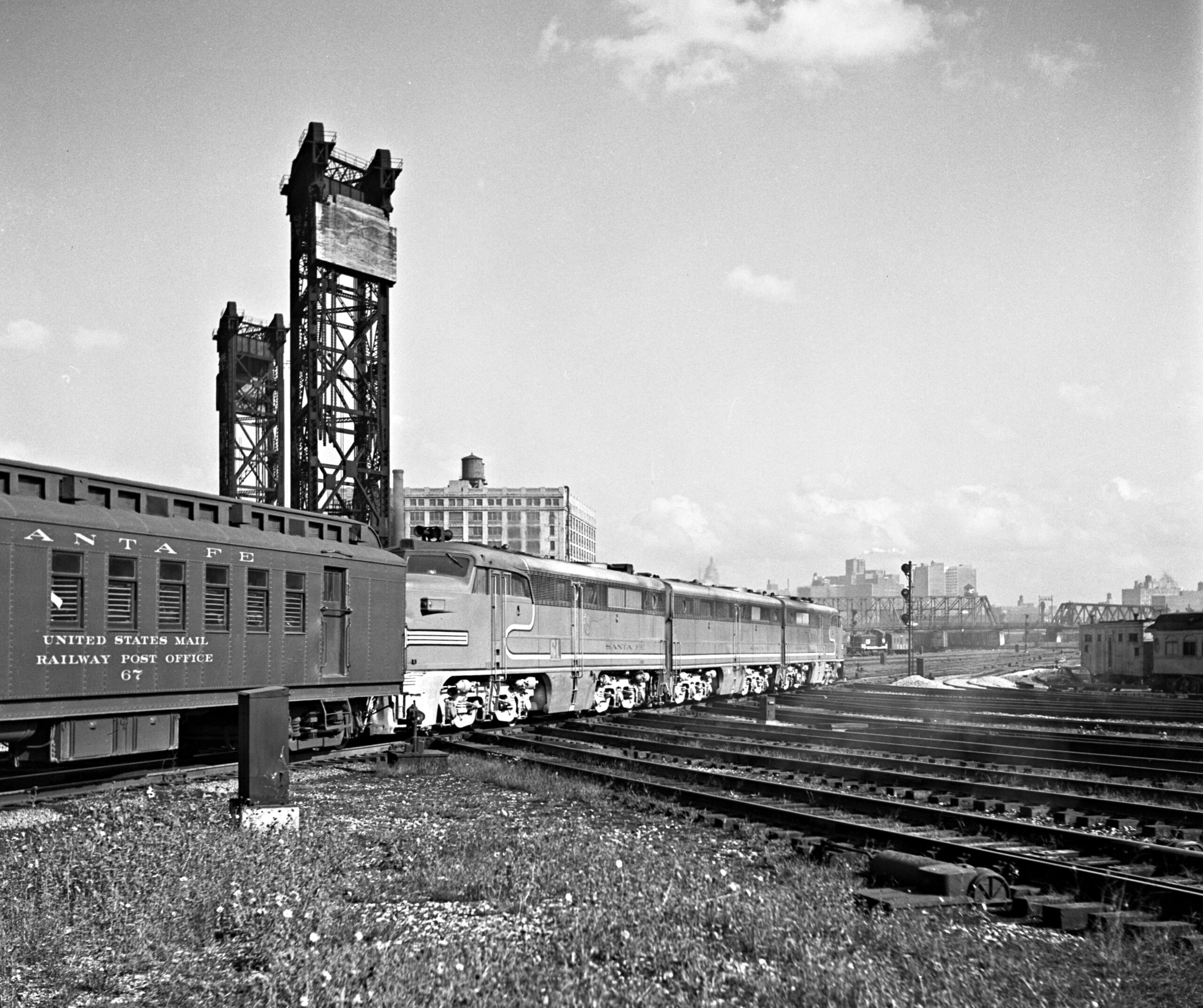
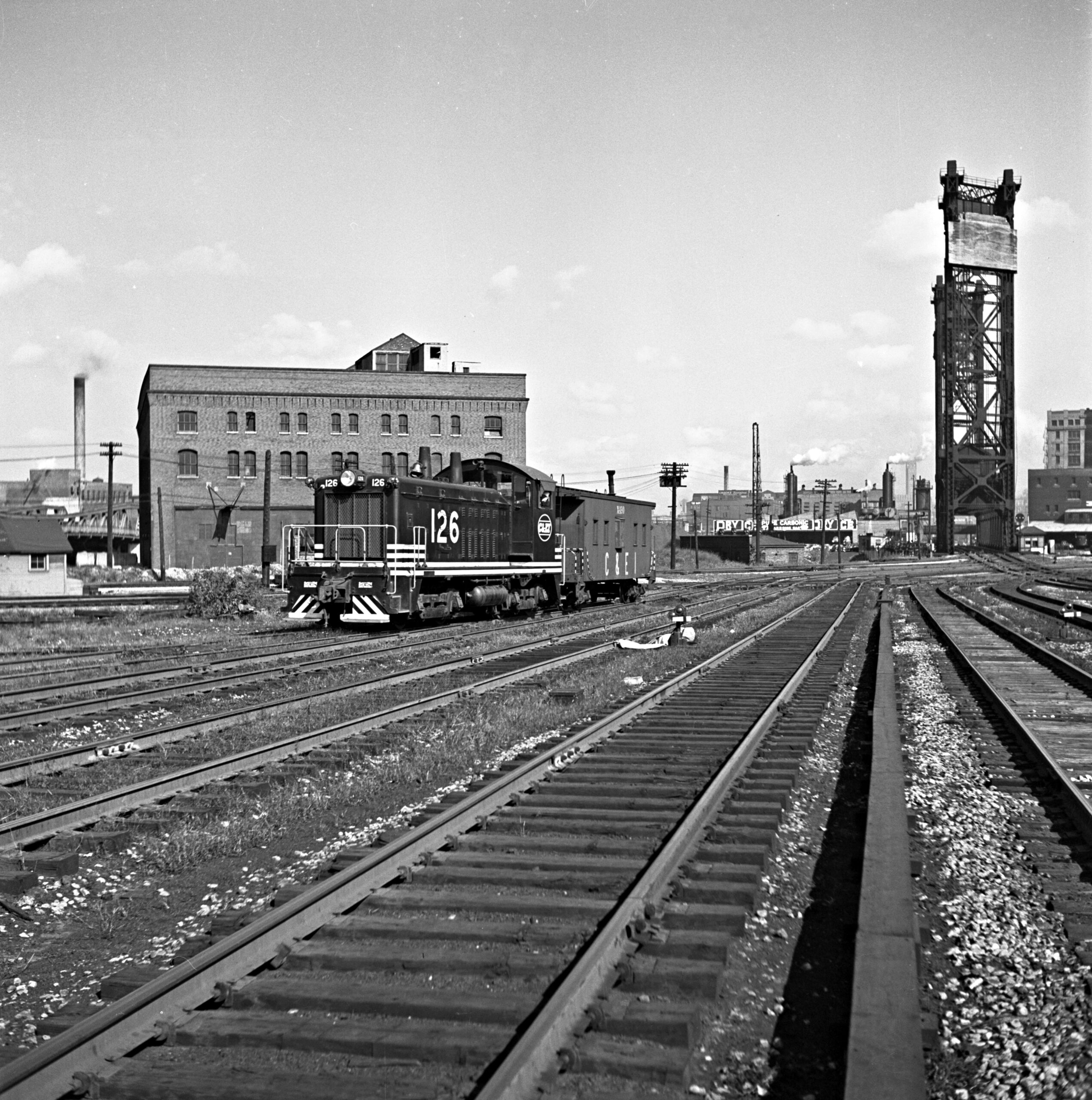
Just ahead of its 9:00 a.m. arrival into Dearborn Station, Santa Fe’s Texas Chief rolled through 21st Street behind a trio of Alco PA and PB locomotives. Lurking just beyond them in the first photograph was a Chicago & Eastern Illinois caboose hop, which came through the interlocking after the Texas Chief passed. SW7 126 was barely seven months old at the time. Abbey-01-128-003 and -006
9:00 a.m.
Arrival of the Broadway Limited
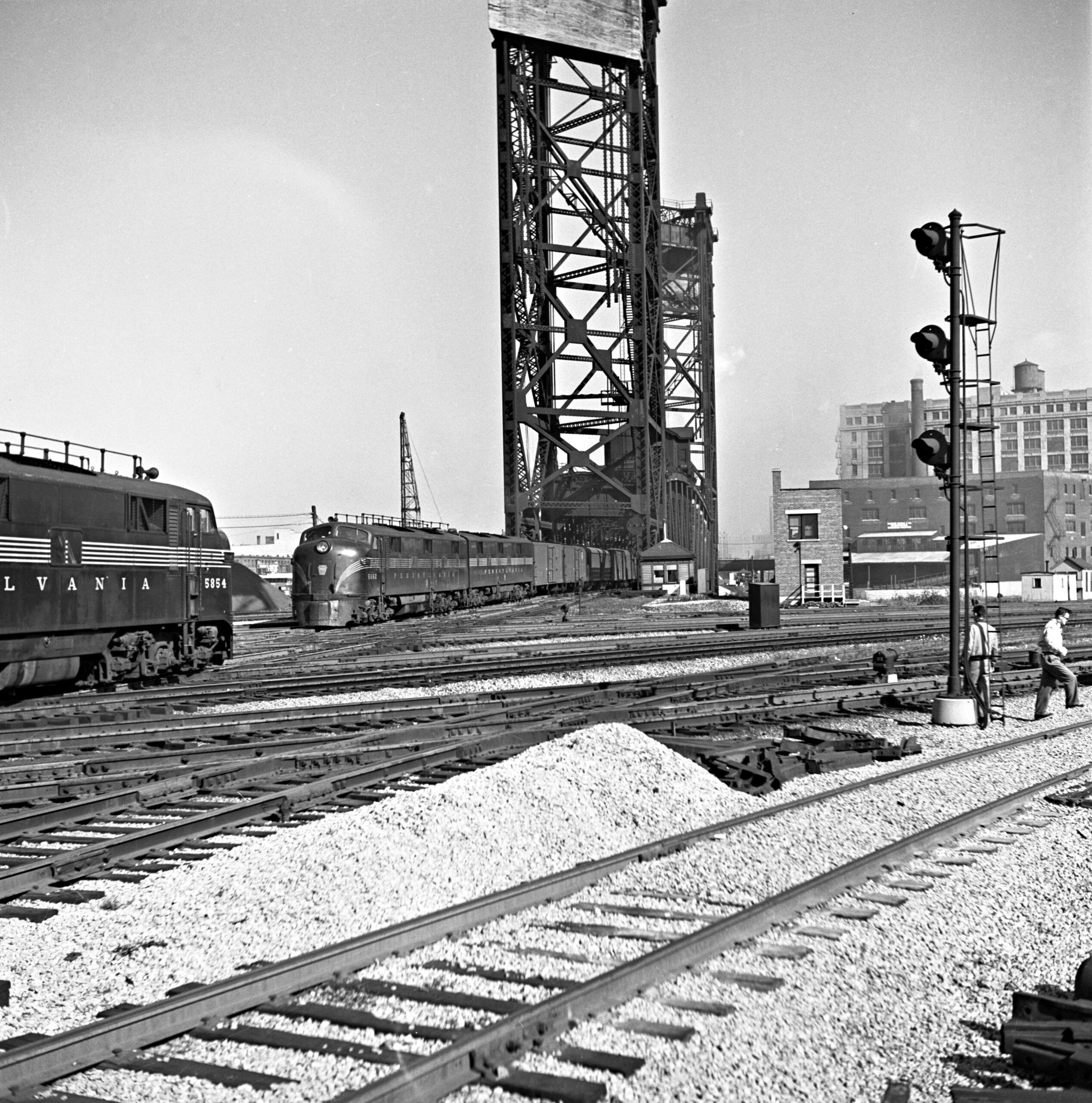
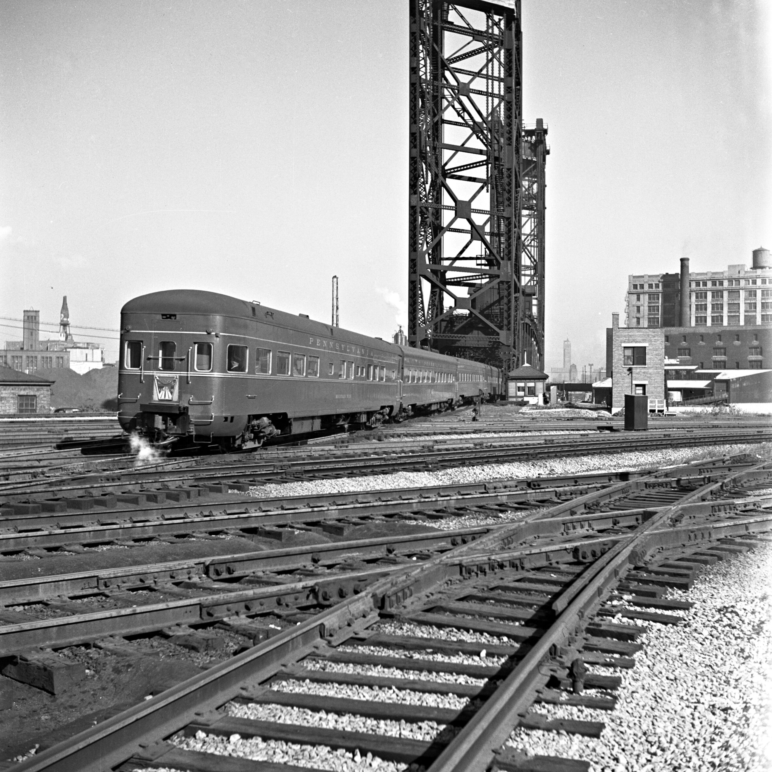
Due into Chicago at 9:00 a.m., the Broadway Limited, flagship of the Pennsylvania Railroad, came in from the left as an eastward train departed. If the Broadway was running a couple of minutes late, the other train could have been no. 216 for Cincinnati, which left Chicago at 9:00. On the other morning of his two-day visit, Abbey stood closer to capture the Broadway’s characteristic blunt-end observation car. Abbey-01-127-008 and -012
9:10 a.m.
Monon to Indianapolis
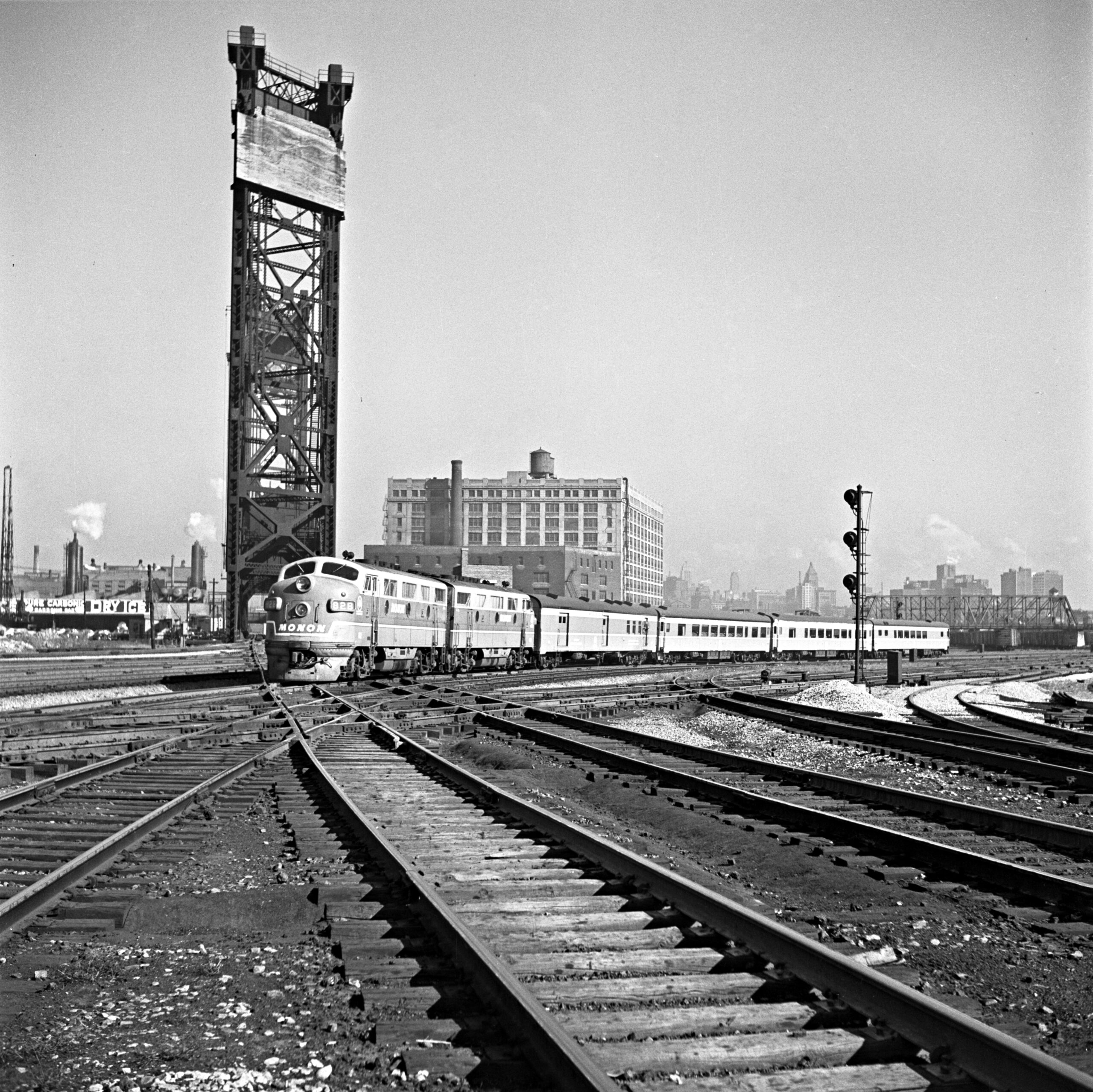
Monon train no. 11, the Tippecanoe, crossed the Pennsylvania main line just after pulling out of Dearborn Station at 9:05 for its four-hour, five-minute trek to Indianapolis. Abbey-01-128-001
9:15 a.m.
Illinois Central freight transfer
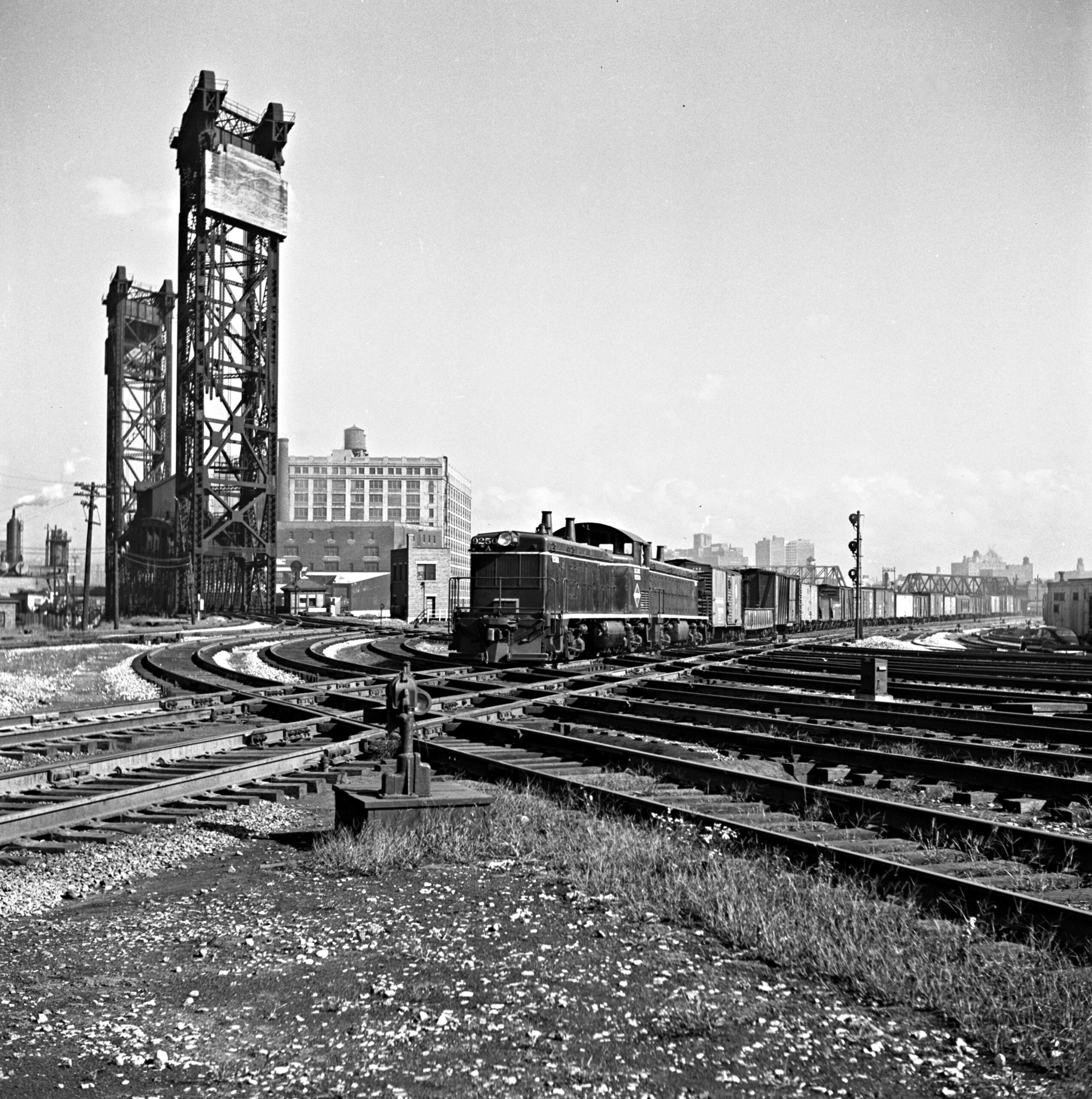
In between the many morning passenger trains, an Illinois Central freight transfer out of Markham Yard rattled seven of the diamonds at 21st Street. The power was a TR1 cow-calf switcher, one of only two pairs EMD ever built, both for the IC. Abbey-01-129-010
9:35 a.m.
The Kansas Cityan
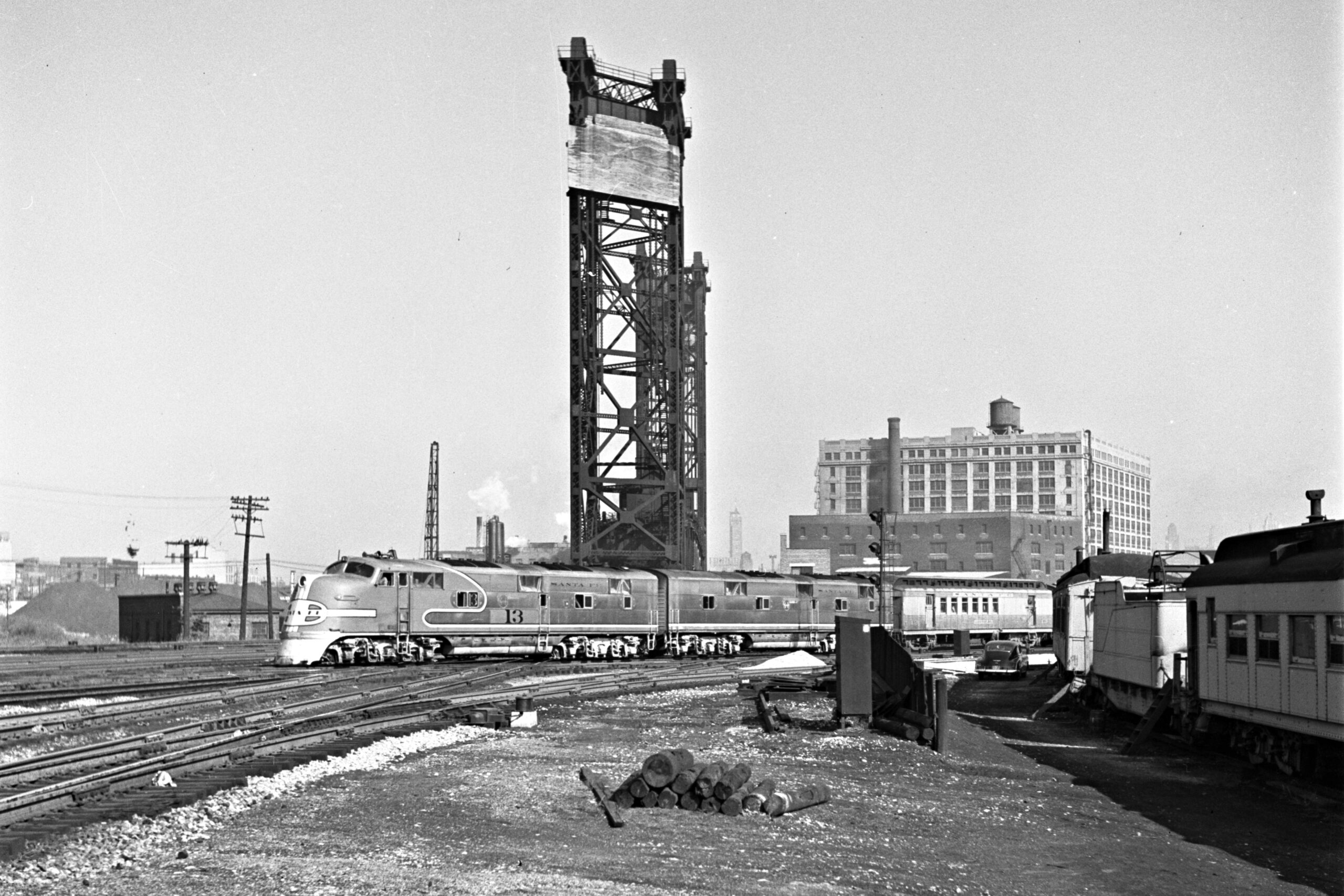
An A-B pair of E6 locomotives–already a decade old–led Santa Fe’s Kansas Cityan through 21st Street a few minutes after its 9:30 a.m. departure from Dearborn Station. It would arrive in its namesake city at 5:00 p.m., covering the 451-mile trip in seven and a half hours. That was an average speed of 60 m.p.h. on a trip with seven intermediate stops. Abbey-01-129-010
9:45 a.m.
The Maple Leaf steams off for Toronto
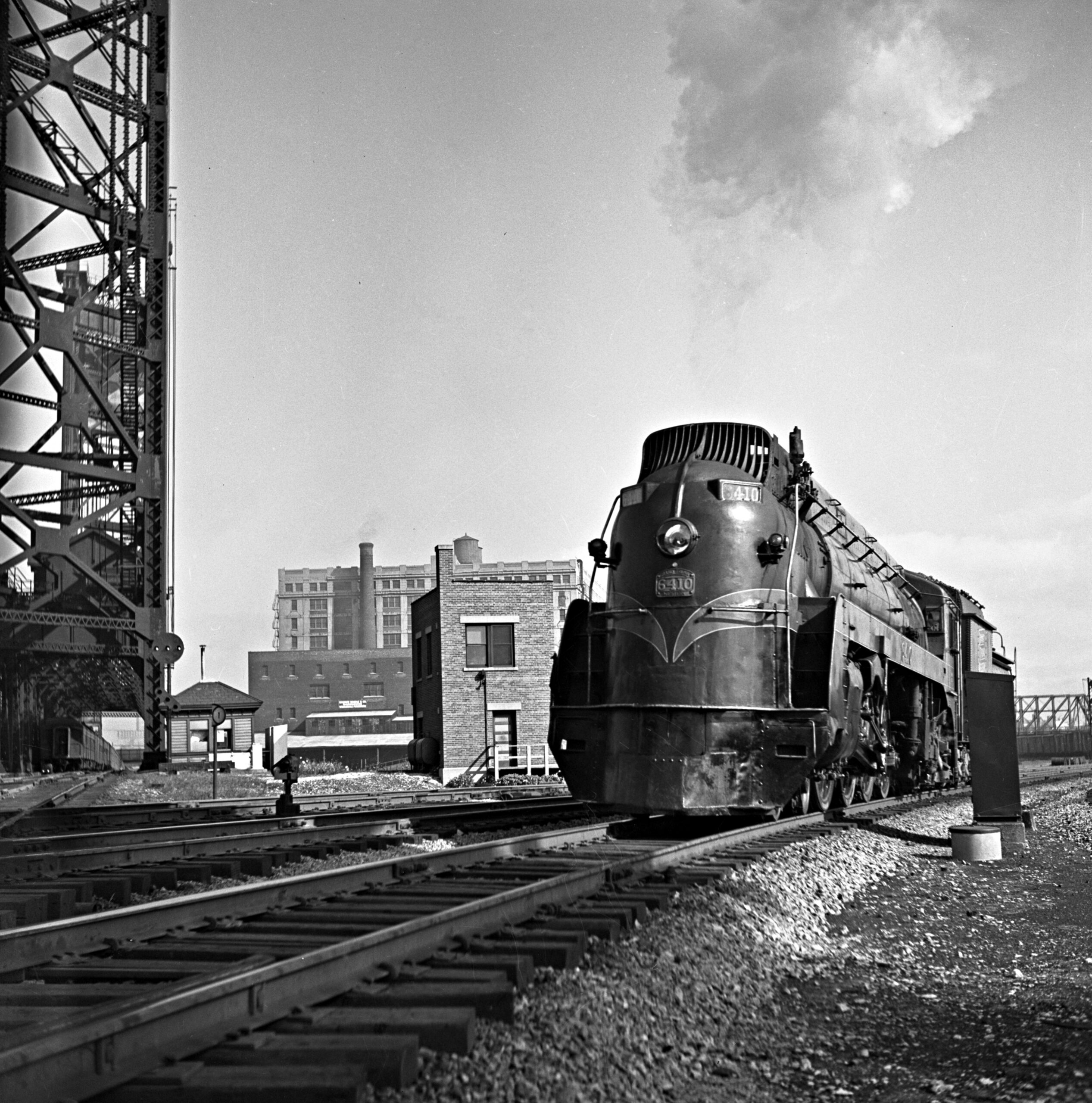
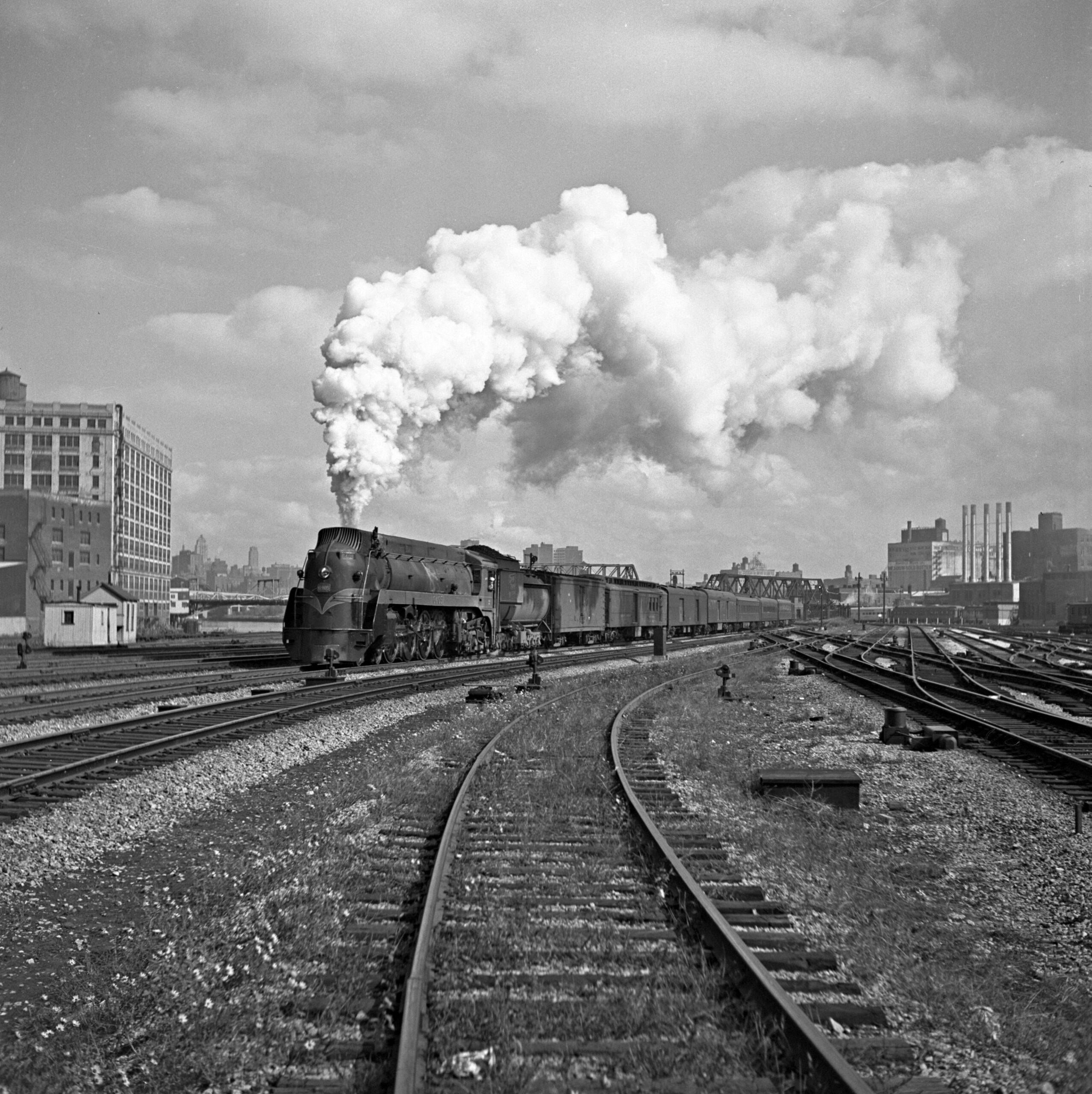
Grand Trunk Western 6409 backed through 21st Street (as an inbound Pennsy train crossed the lift bridge) and later came charging out with train no. 20, the Maple Leaf for Toronto, which left Dearborn Station at 9:40 a.m. Central Time and was due at its destination at 10:05 p.m. Eastern. The semi-streamlined 4-8-4 led the train on both mornings of Abbey’s visit, one of only a few steam locomotives he encountered. Abbey-01-126-011 and -129-006
9:55 a.m.
Slow train to New York
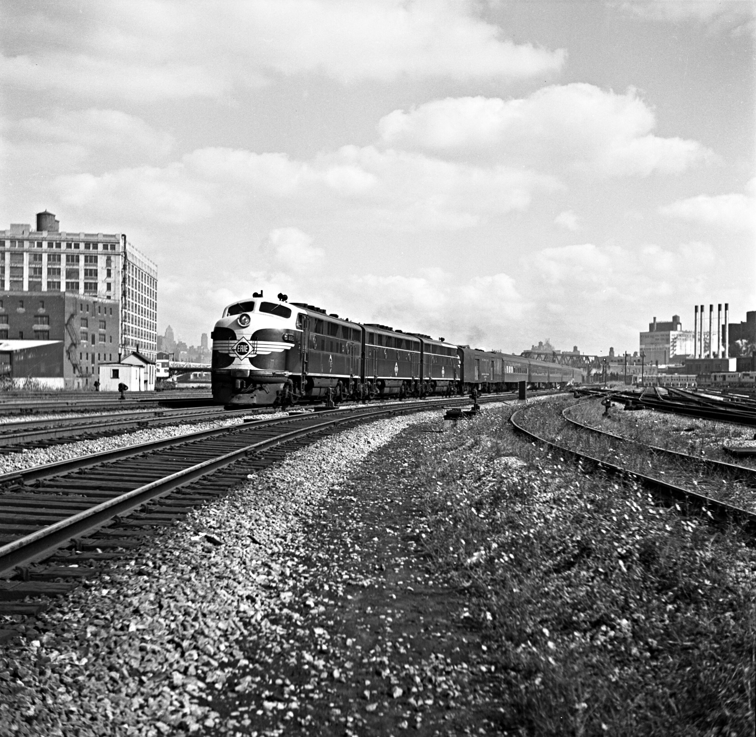
Scheduled out of Dearborn Station ten minutes behind the Maple Leaf was Erie Railroad train no. 6, The Lake Cities, which Abbey photographed with an A-B-A set of F3 locomotives on the second morning of his 21st Street assignment. The train took 21 hours to cover the nearly 1,000 miles to Jersey City, where the railroad offered bus connections that brought its passengers to downtown New York 30 minutes later. By comparison, the crack Chicago-New York trains of the era—Pennsylvania’s Broadway Limited and New York Central’s 20th Century Limited—each made the run in 16 hours. Abbey-01-129-003
10:20 a.m.
The Dolton commuter
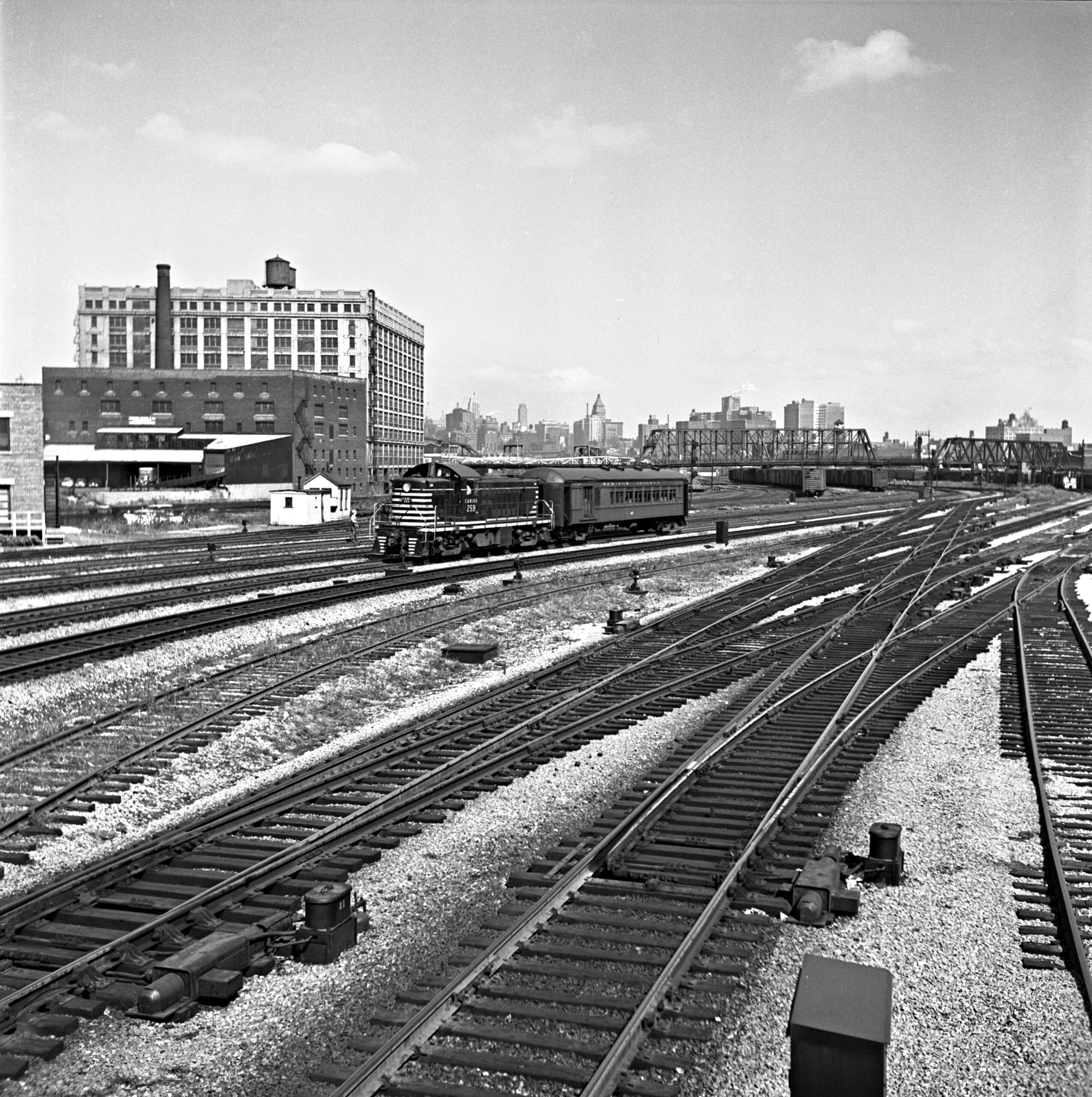
In addition to shuffling passenger train consists for several other railroads, the Chicago & Western Indiana operated its own—albeit rather modest—commuter service. At 10:15 a.m., an RS1 departed from Dearborn Station with train no. 71—a former Pennsylvania Railroad combine car—for the 16.6-mile run to Dolton. The service lasted until 1963. Abbey-01-129-009
11:00 a.m.
Coast-to-coast sleeping car
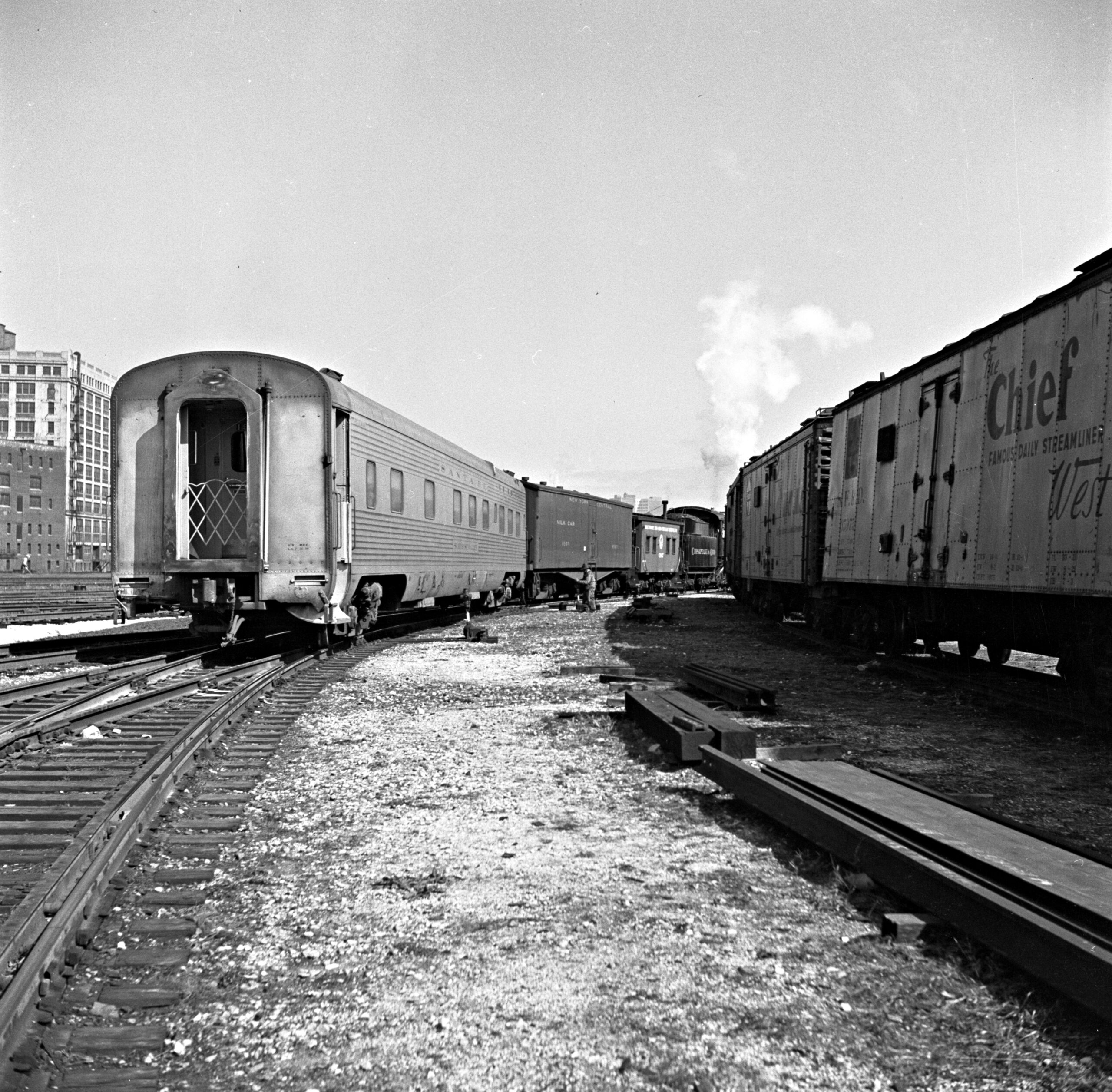
A Chesapeake & Ohio steam switcher brought Baltimore & Ohio’s “coast-to-coast” sleeping car through 21st Street in what was at the time a daily transfer between Grand Central and Dearborn stations. The sleeper arrived in the morning on B&O’s Capitol Limited from Washington, D.C., and left for Los Angeles each afternoon on Santa Fe’s Chief. Similar transfers happened daily with the New York Central and the Pennsylvania. Abbey-01-125-008
11:05 a.m.
The Banner Blue
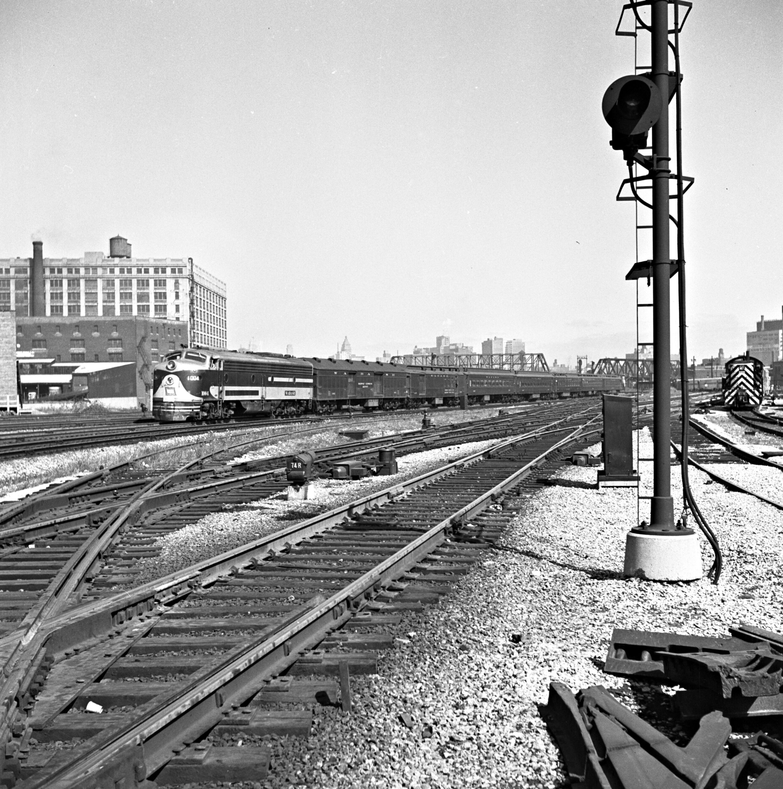
A single E-unit led Wabash no. 11, the Banner Blue for St. Louis, out of Dearborn Station and through 21st Street just after the train’s 11:00 a.m. departure time. Still composed entirely of heavyweight cars, it was scheduled to make the 286-mile run in five hours and 35 minutes. Note the Santa Fe switcher with a streamlined passenger consist at far right. Abbey-01-125-002
11:30 a.m.
The Chief arrives in two sections
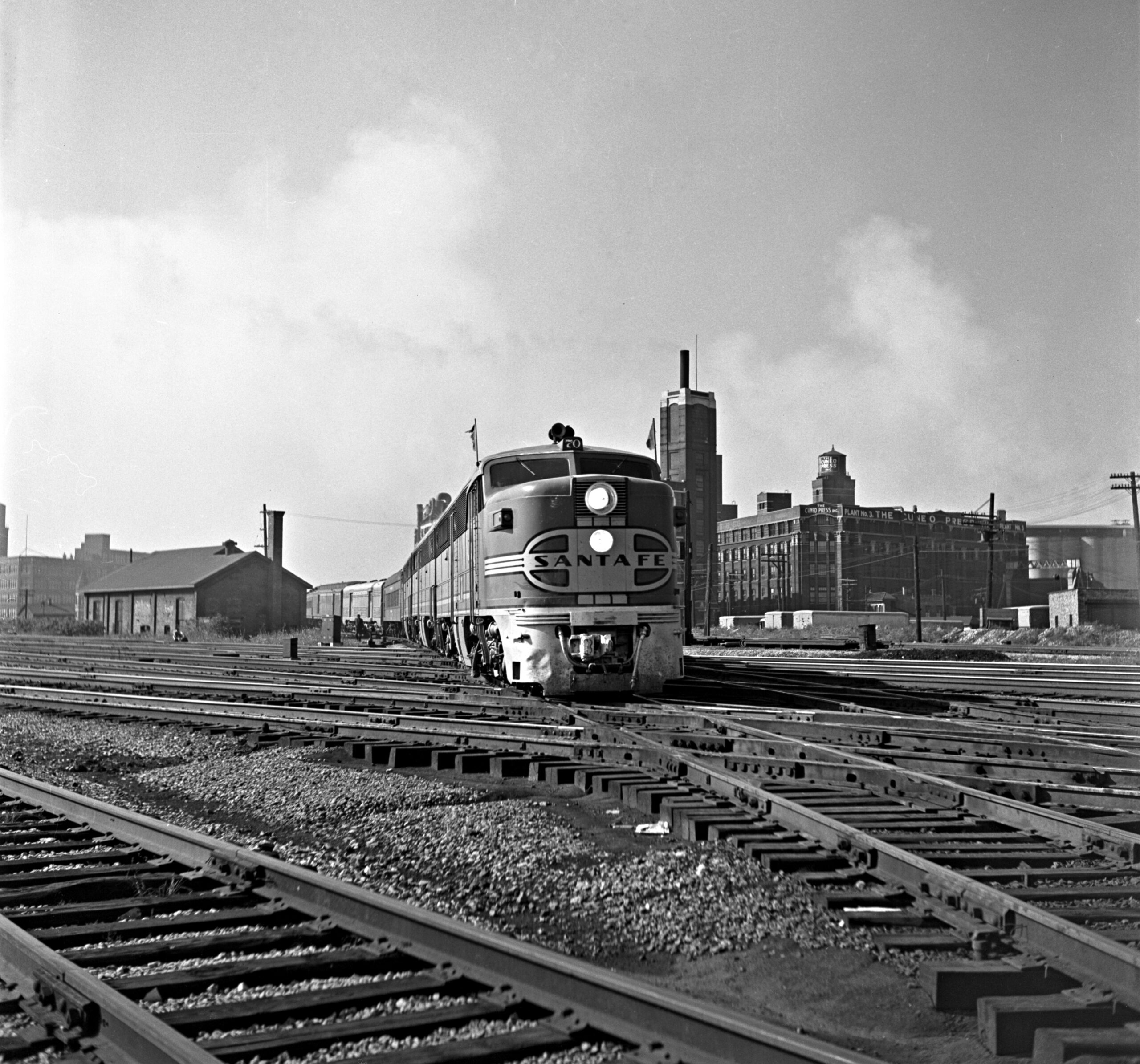
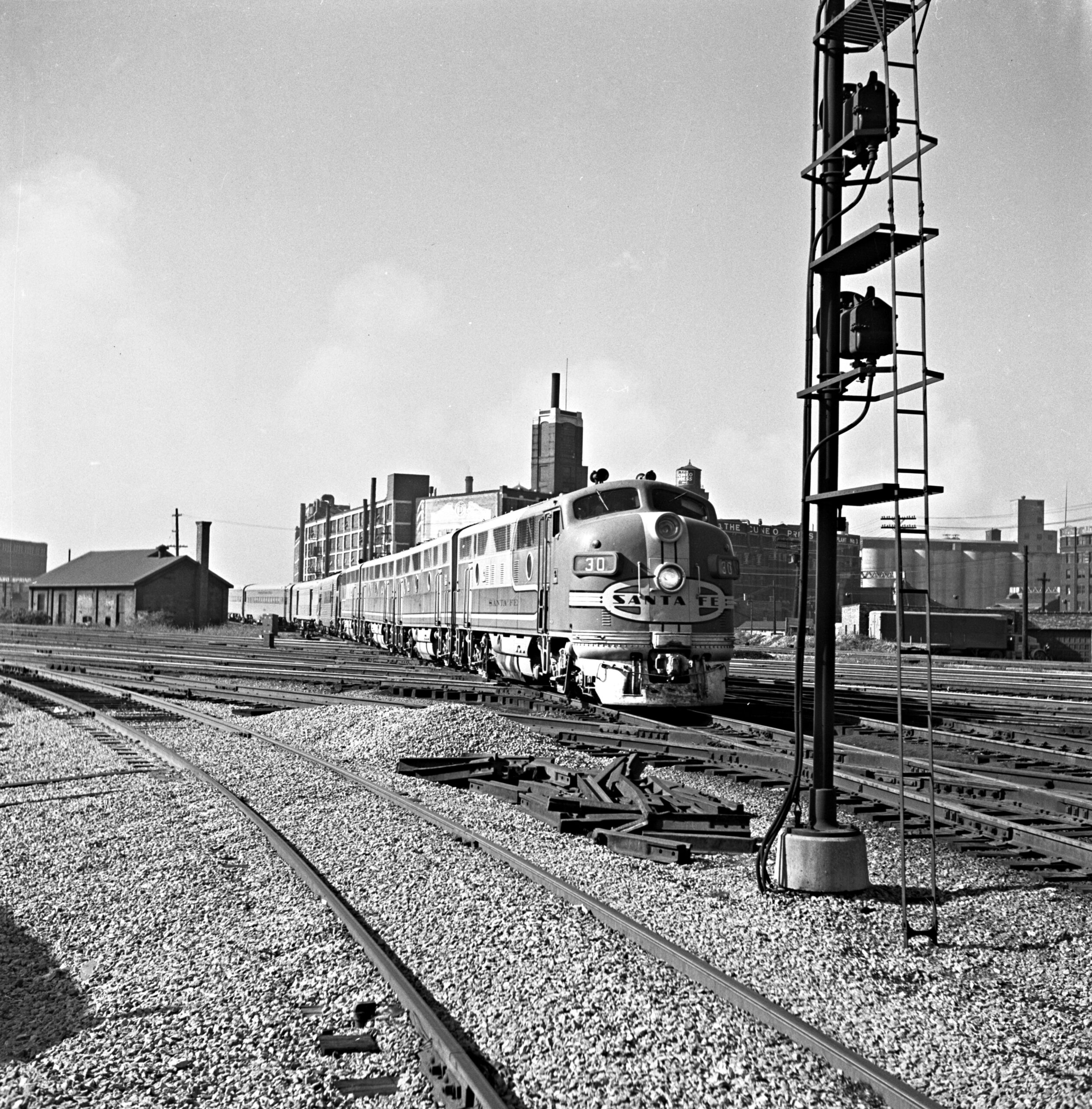
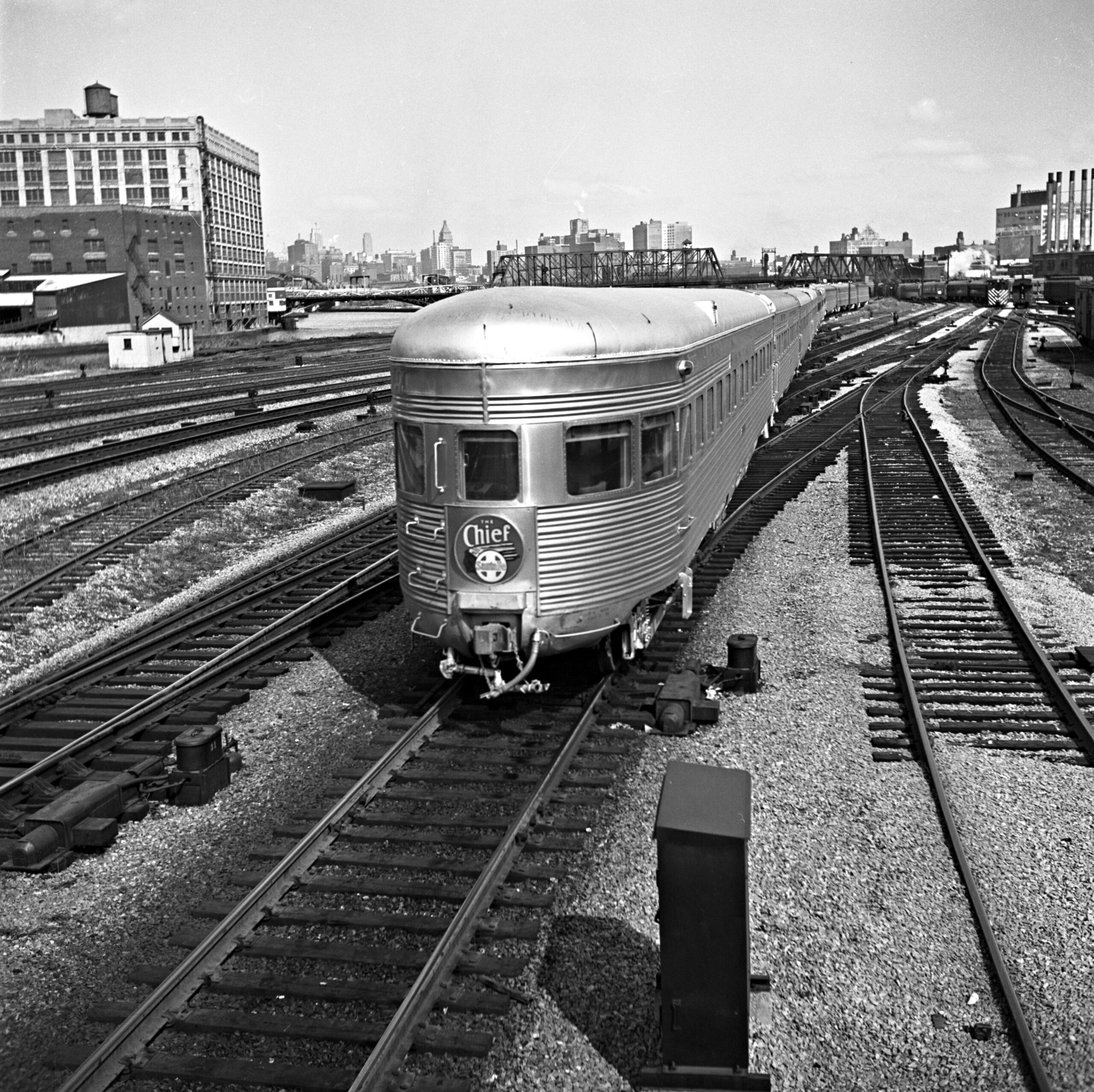
Many of the principal passenger trains serving Chicago in 1950 frequently ran in multiple sections. Near midday, Santa Fe’s Chief from Los Angeles rolled in behind Alco PA1 locomotive 70, flying green flags to indicate a following section—which arrived a few minutes later behind a quartet of EMD F3s. Abbey-01-126-008, -128-010, and -129-012
11:35 a.m.
Passenger meets freight on the Pennsy
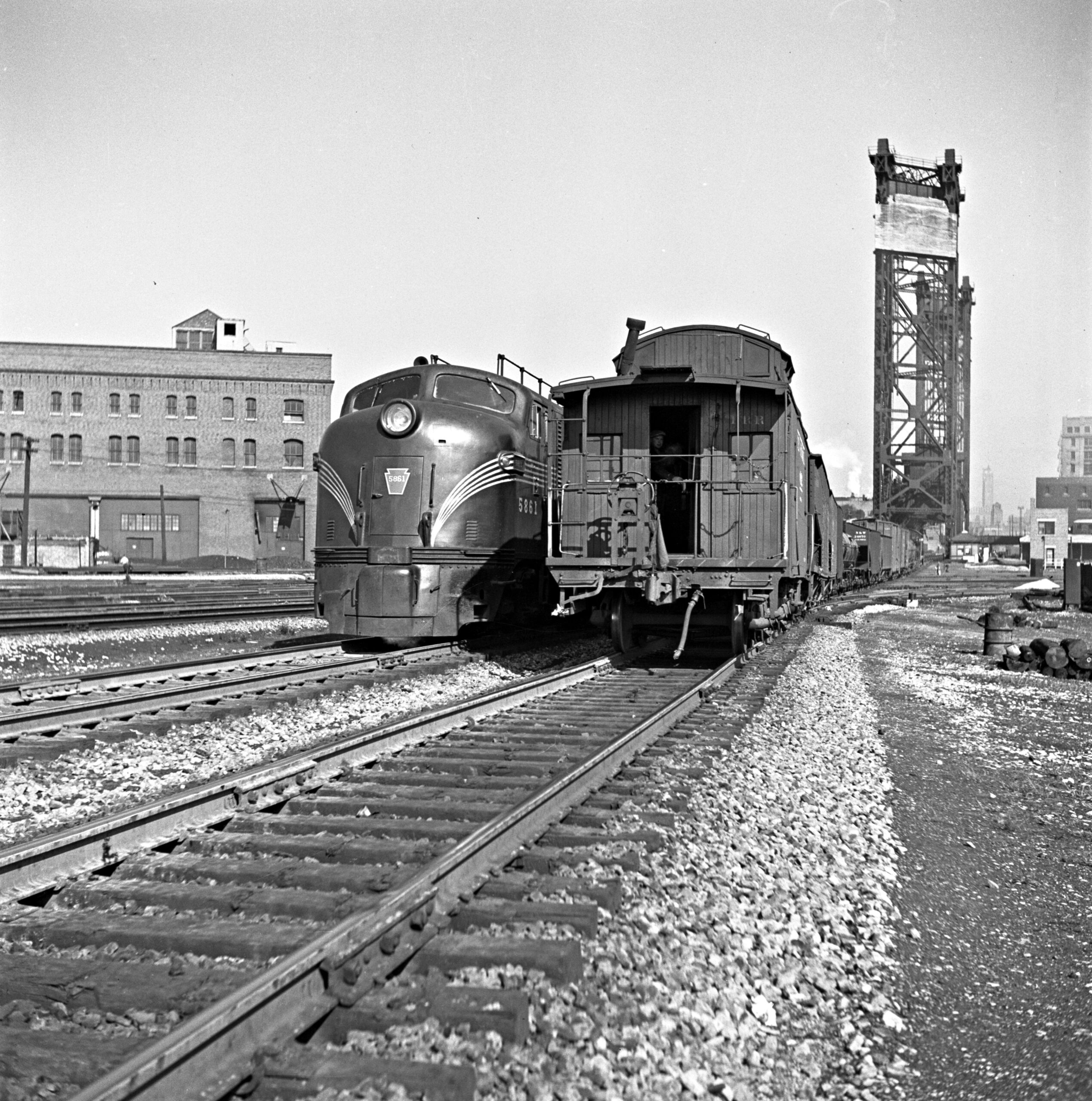
In the late morning, an outbound Pennsylvania Railroad passenger train—possibly no. 22, the Manhattan Limited, which left Union Station at 11:30 a.m.—passed an inbound freight transfer with a wood caboose. Abbey-01-131-007
11:50 a.m.
The Alton Limited
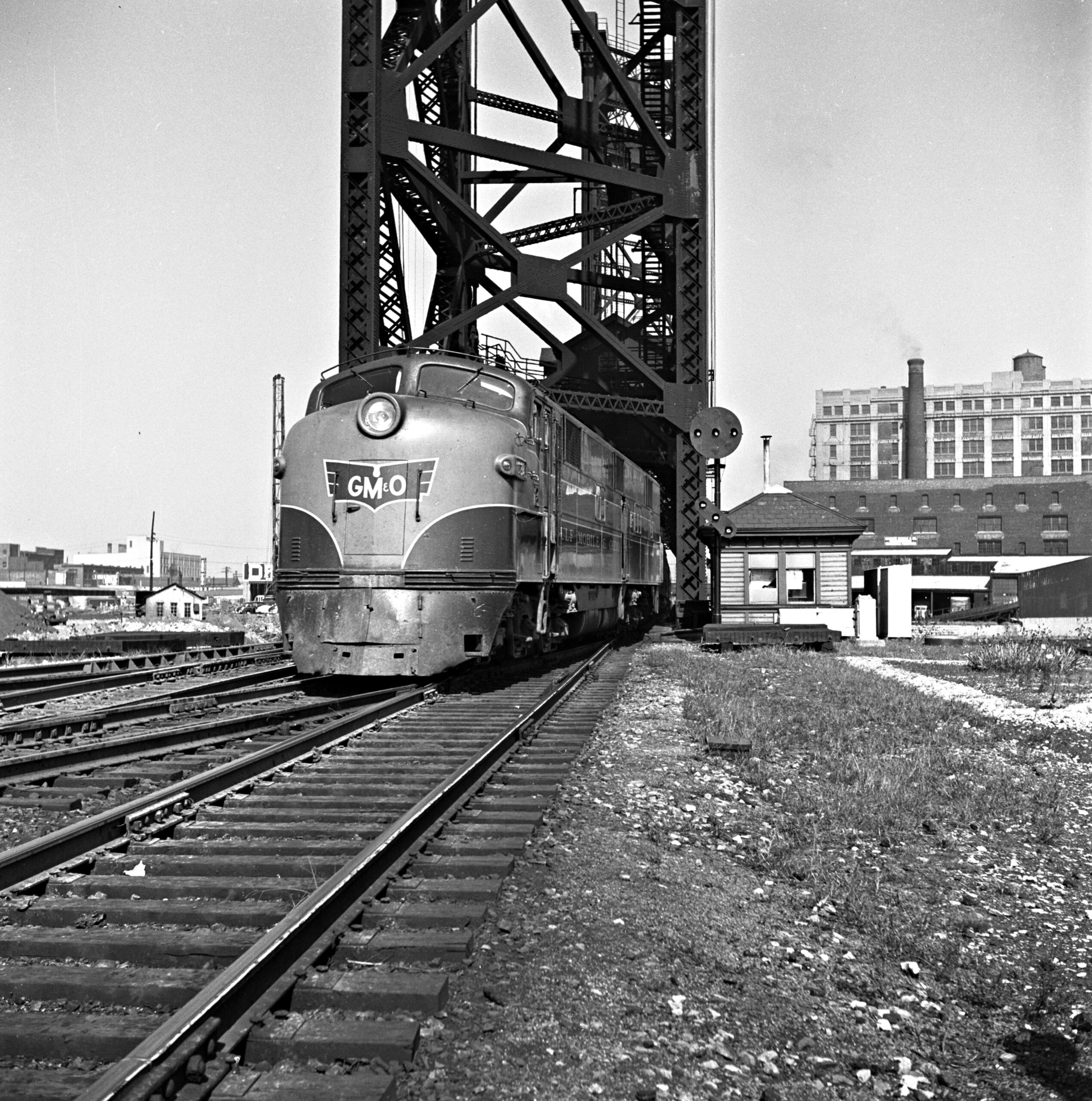
Gulf, Mobile & Ohio’s Alton Limited for St. Louis departed Union Station at 11:45 a.m. and crossed the lift bridge over the South Branch of the Chicago River a few minutes later. Abbey-01-125-001
11:55 a.m.
The Meadowlark
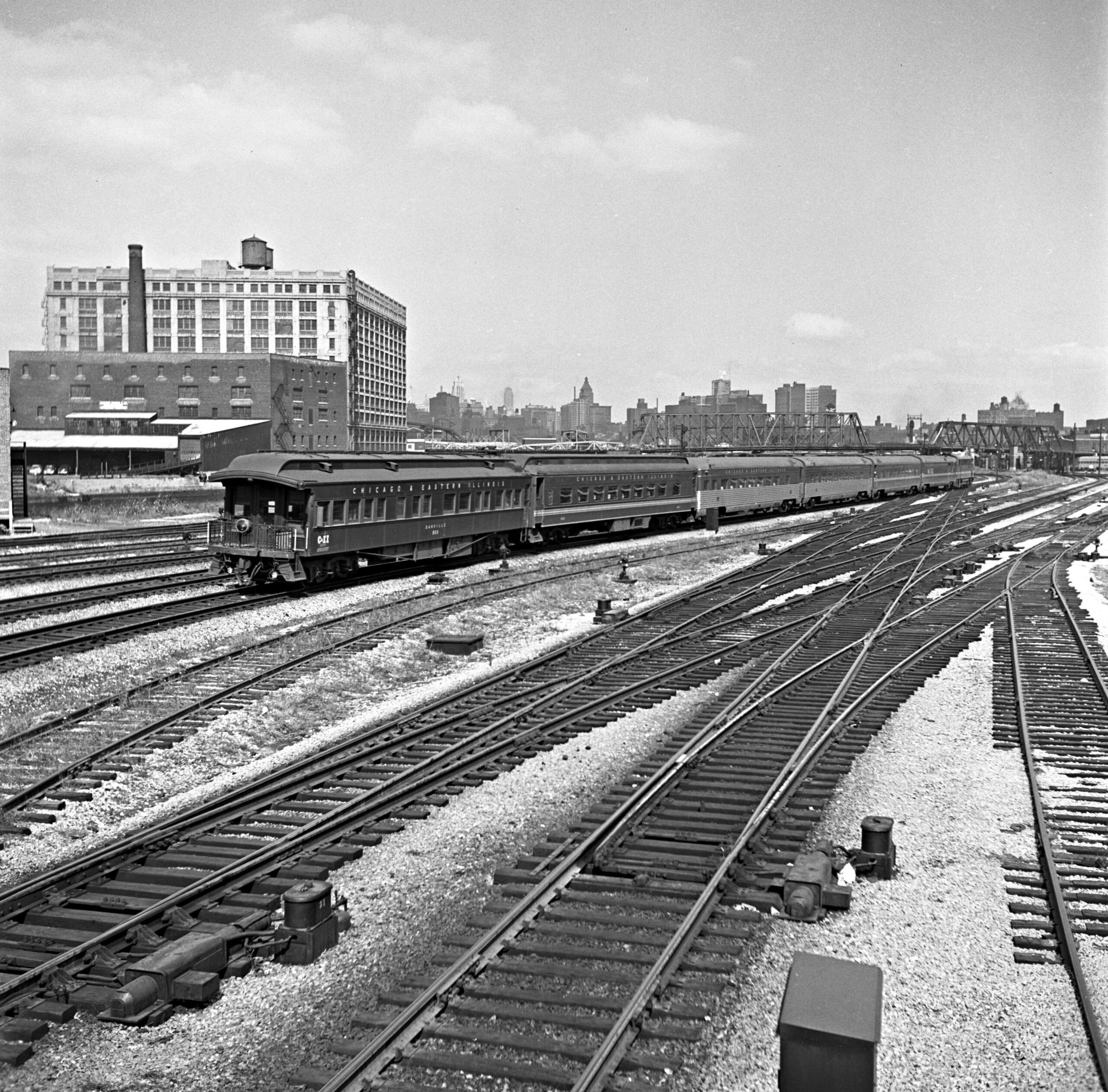
Just before Noon, Chicago & Eastern Illinois train no. 12, the Meadowlark from southern Illinois, pulled in with two heavyweight cars, including an open-platform observation car, bringing up the rear. Abbey-01-129-002
12:00 p.m.
Thru sleeper from the Admiral
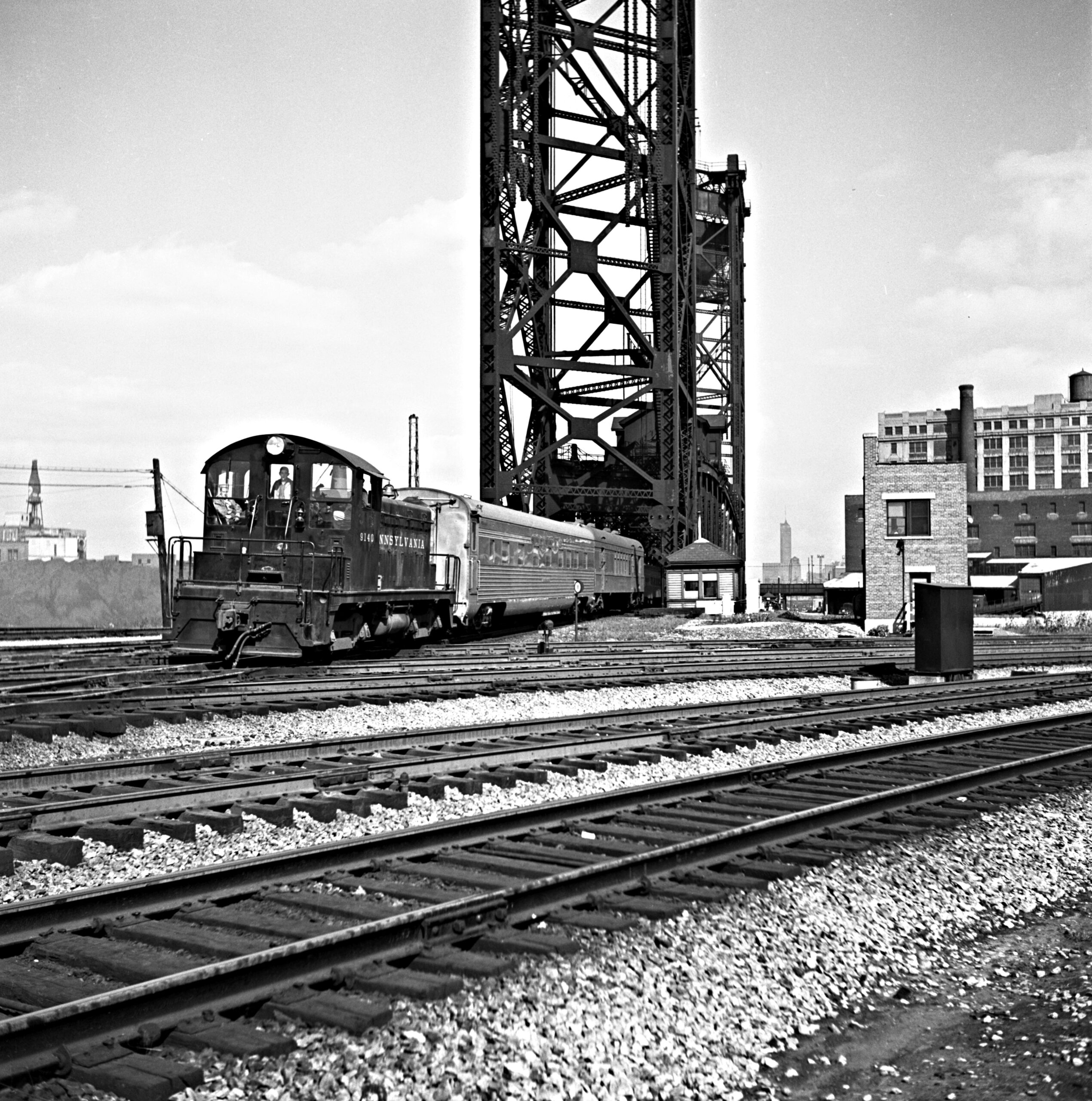
At midday, a Pennsylvania Railroad diesel switcher pulled a through sleeper from the Admiral, train no. 71, which had arrived from New York at 10:45 a.m. The car was bound for Dearborn Station for inclusion in Santa Fe’s Chief to Los Angeles in the early afternoon. Abbey-01-128-002
12:00 p.m.
The Land O’ Corn
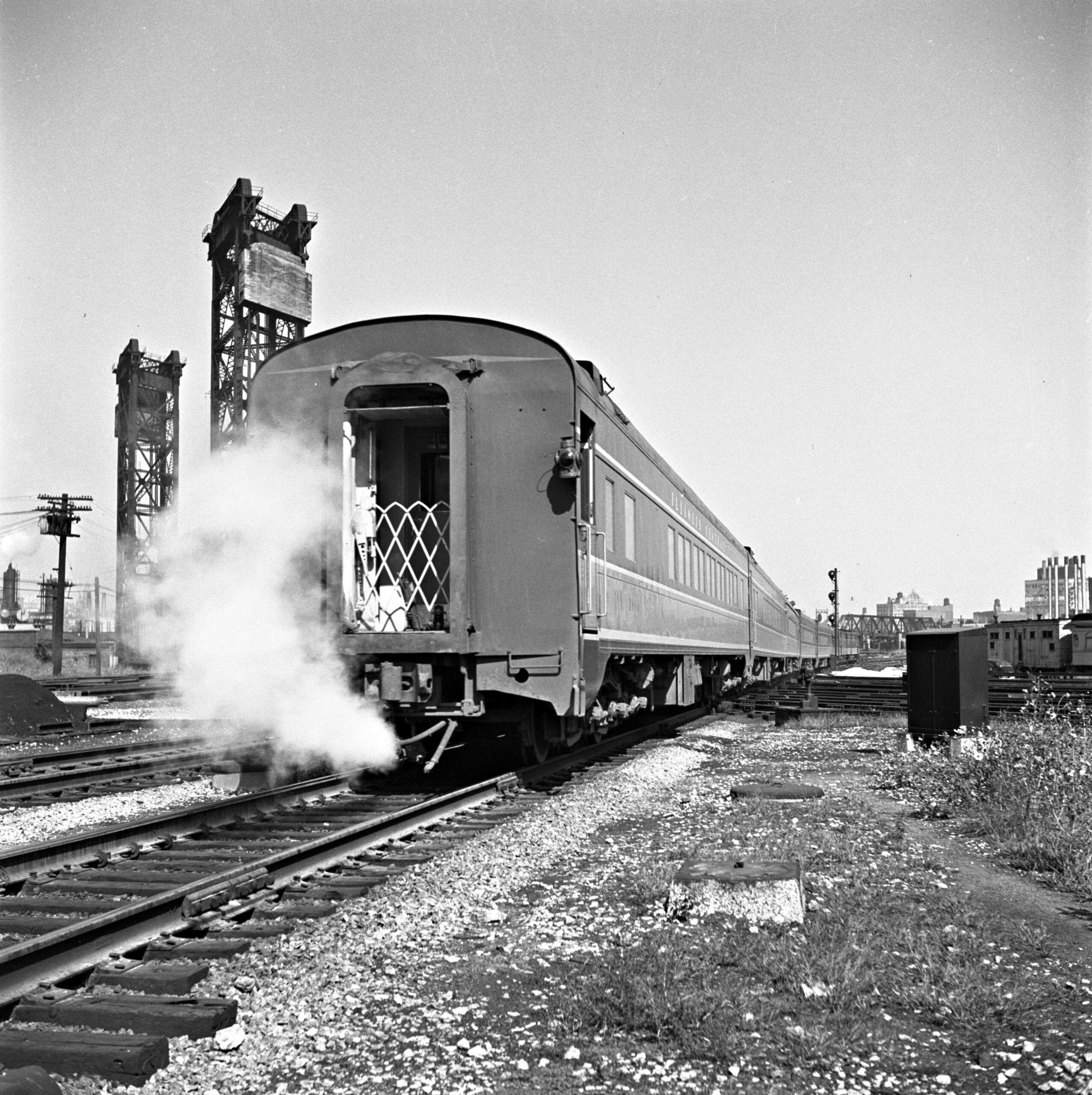
Trailing a wisp of steam from its heating line, Illinois Central’s Land O’ Corn rolled off the last few miles of its daily trek from Waterloo, Iowa, to Chicago, where it was due into Central Station at 12:15 p.m. Abbey-01-124-001
12:05 p.m.
The Grand Canyon
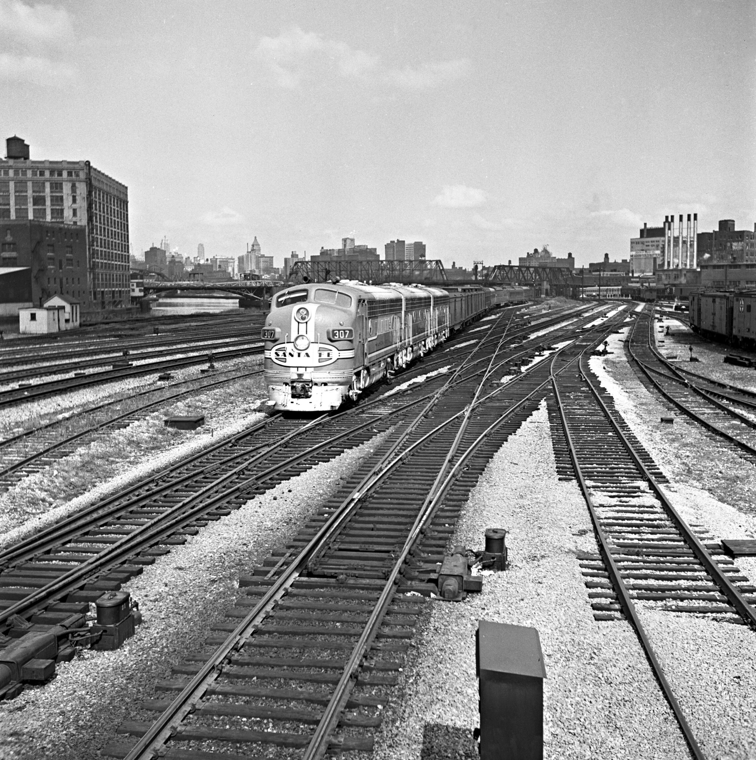
Santa Fe’s Grand Canyon, train no. 23 for Los Angeles, was scheduled out of Dearborn Station at 12:01 p.m. and often ran in multiple sections. This trio of F7 locomotives was leading Second 23 with ten cars. Just to the left of the 307’s windows, a double-bascule lift bridge carries 18th Street over the South Branch of the Chicago River. Abbey-01-129-005
12:05 p.m.
One-car train
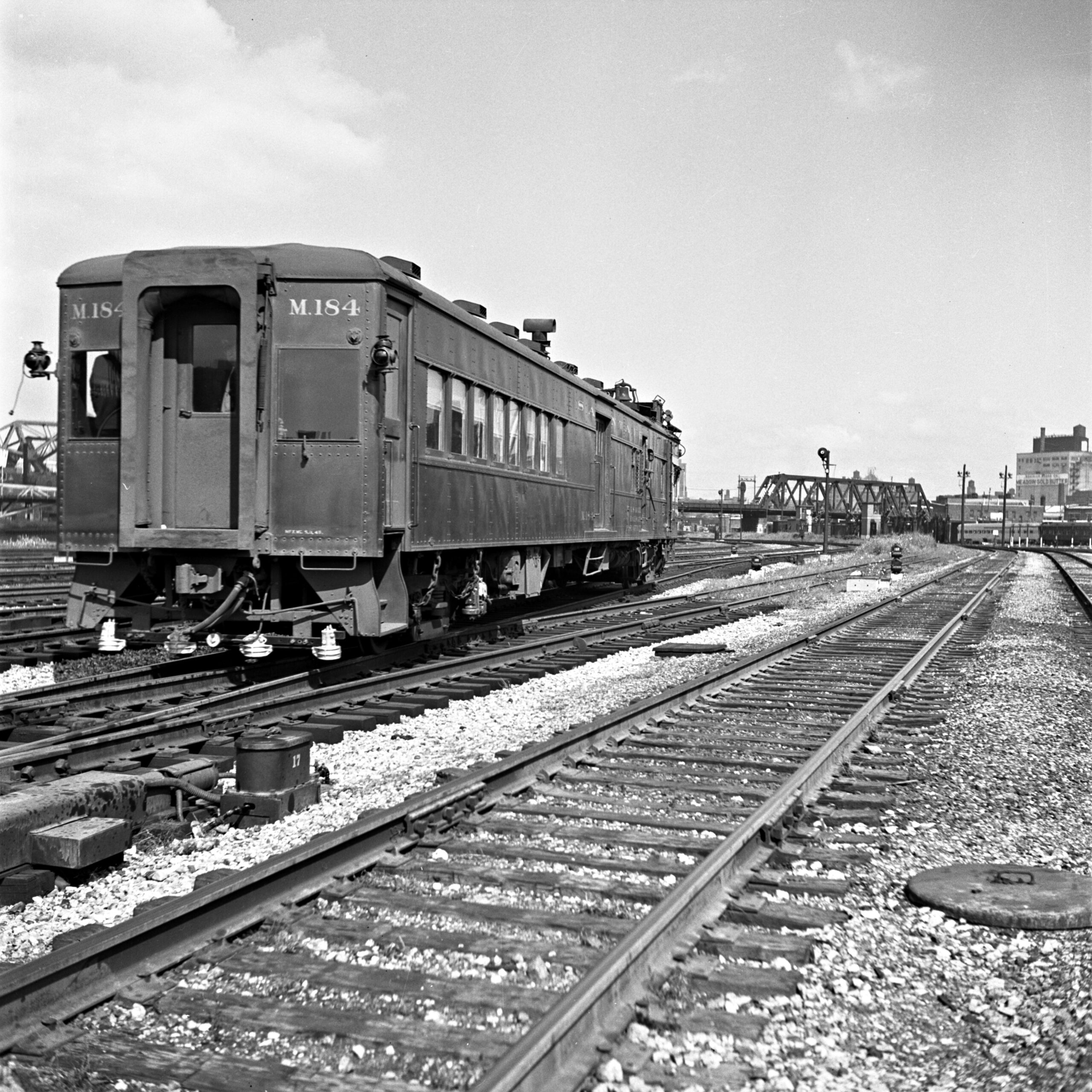
The shortest train to operate through 21st Street was Santa Fe’s single-car local no. 14, running this day with diesel-electric motorcar M.184. It had left Ancona, Illinois, at 9:05 a.m., and was due into Dearborn at 12:10 p.m. after as many as 18 intermediate stops on the 96-mile run. Abbey-01-131-001
1:05 p.m.
Pennsylvania centipede
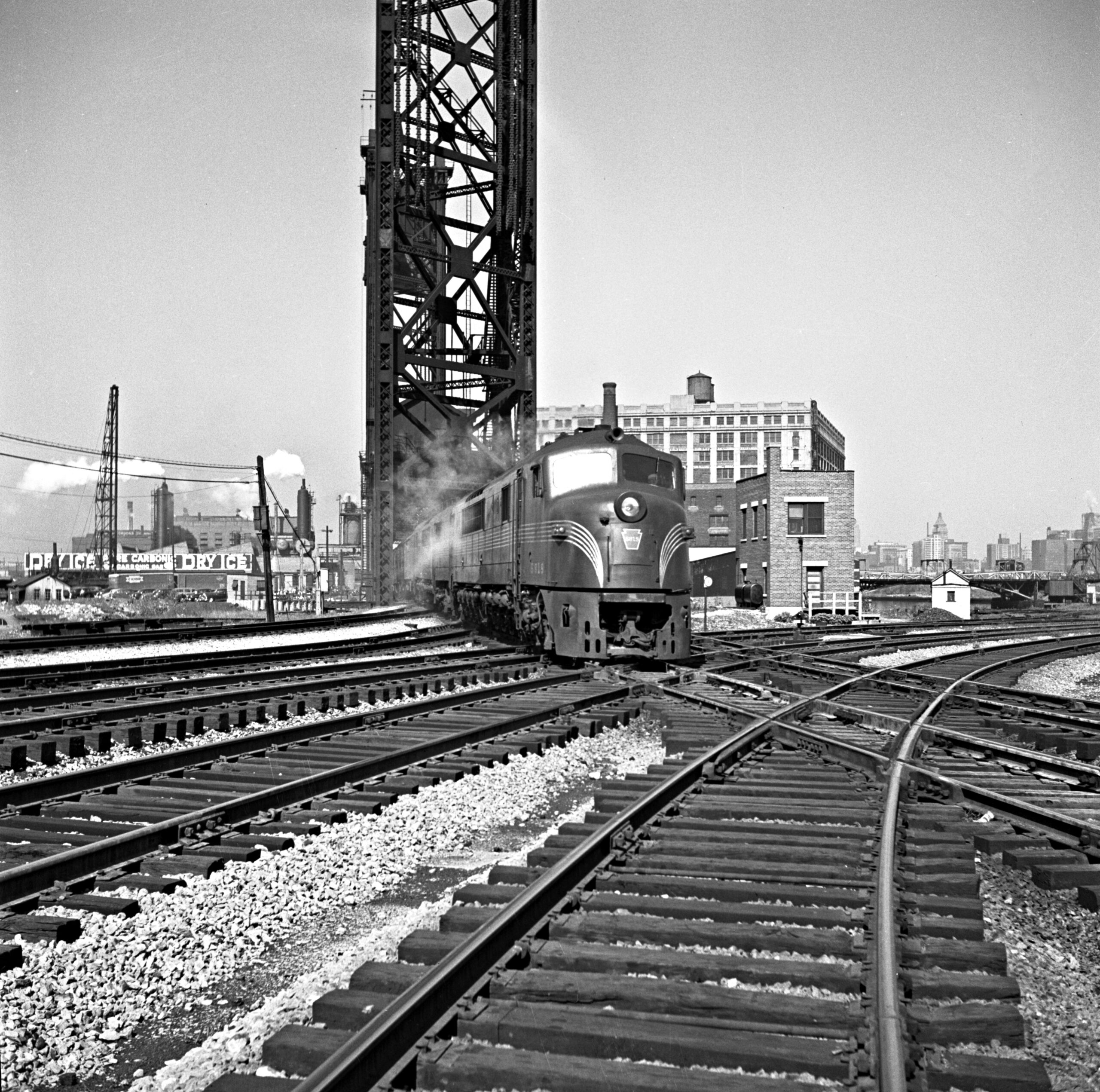
In the early afternoon, a Baldwin “Centipede” diesel locomotive led a Pennsylvania passenger train across the lift bridge and through the interlocking plant of 21st Street. Pennsy rostered 24 of the 12-axle locomotives, which were plagued by reliability issues. The train could be no. 320 for Louisville, Kentucky, which was scheduled out of Union Station at 1:00 p.m. and made the 313-mile run in just under seven hours. Abbey-01-127-002
1:05 p.m.
The Thoroughbred and the Dolton commuter
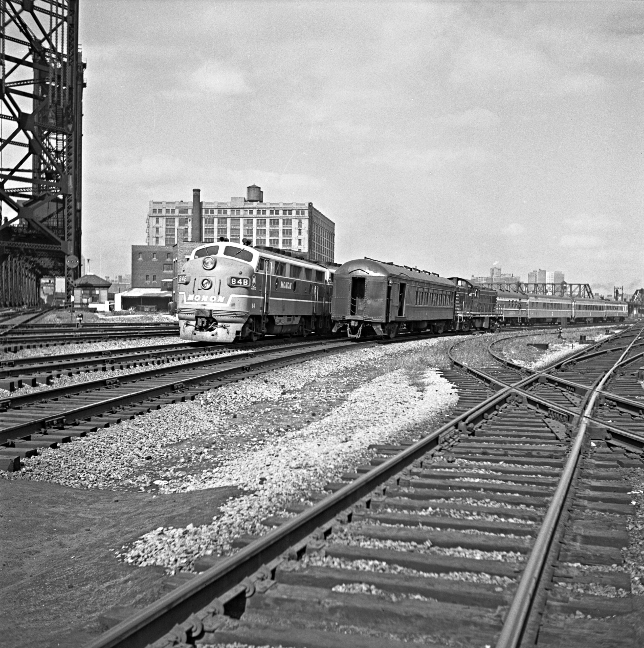
Just after 1:00 p.m., Abbey caught a running meet between Monon train no. 5, the Thoroughbred for Louisville, and Chicago & Western Indiana’s Dolton commuter train returning to Dearborn Station with its RS1 and ex-Pennsy combine. Abbey-01-129-011
1:35 p.m.
The Chief departs in two sections
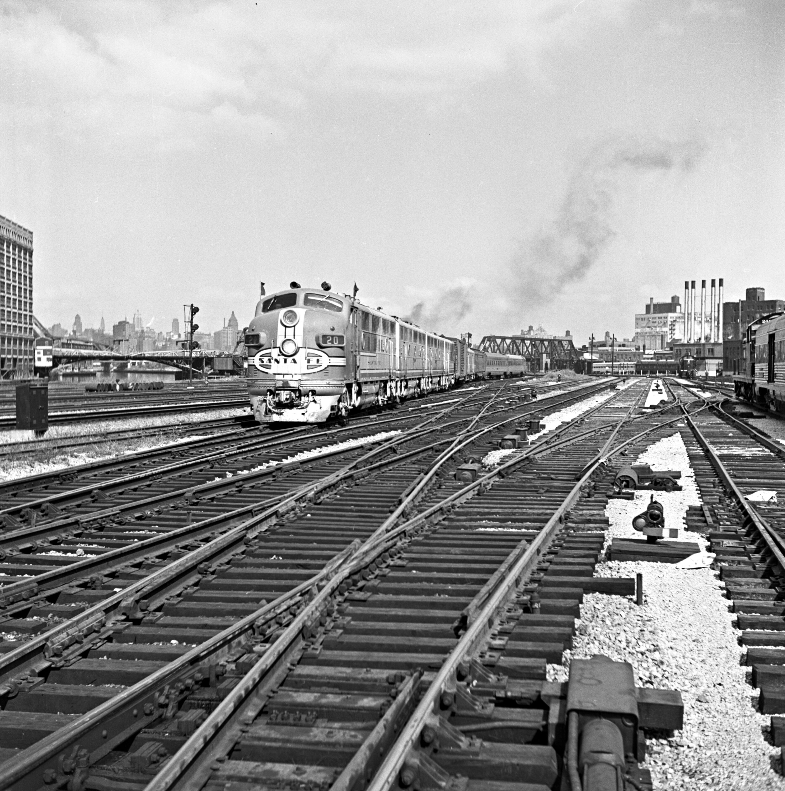
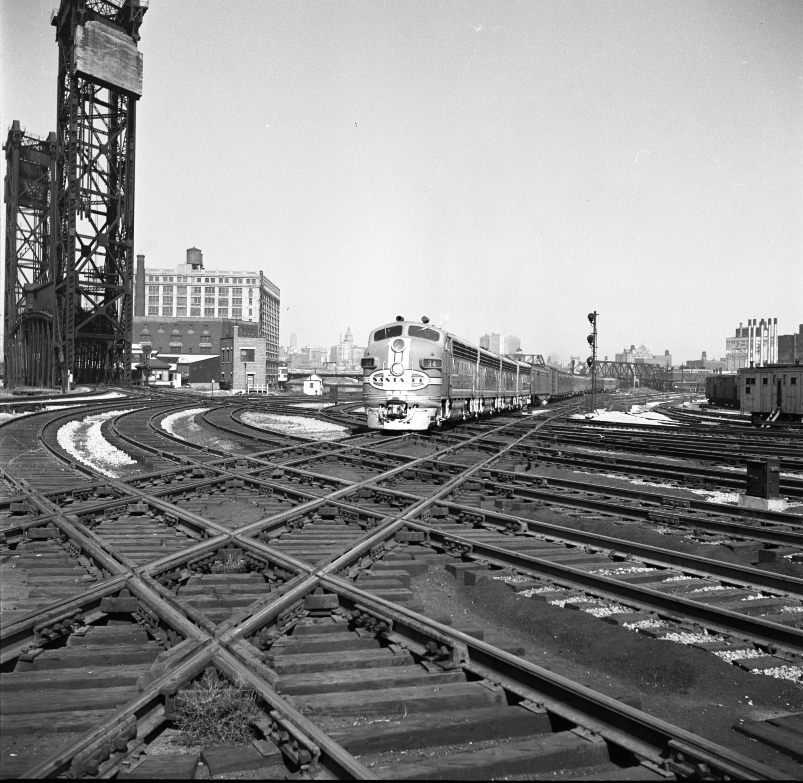
Santa Fe’s Chief for Los Angeles was scheduled out of Dearborn at 1:30 p.m. and frequently ran in multiple sections in 1950. F3A 20 led First 19 with green flags flying; F7A 34 followed a few minutes later with Second 19. Both sections would make the 2,224-mile run in 45 hours. Abbey-01-131-003 and -008
1:40 p.m.
The Super Chief
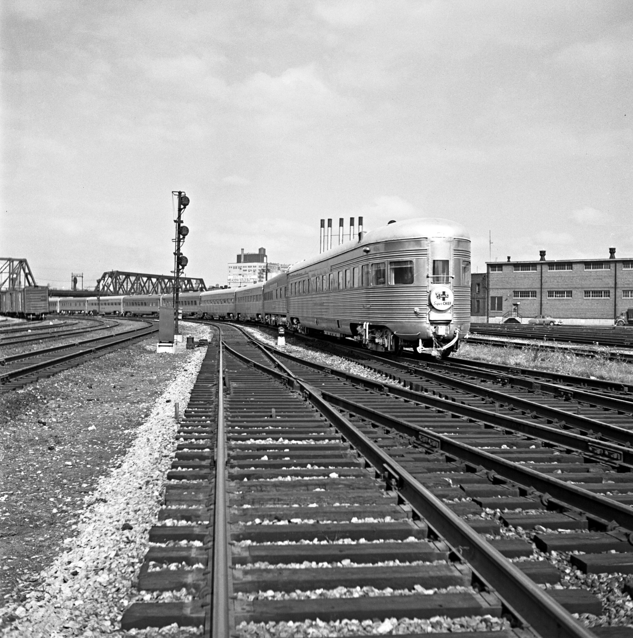
Fastest of all the Santa Fe streamliners was the Super Chief, which made the run from Los Angeles in just under 40 hours. The round-end observation car of train no. 18 had just cleared the diamonds of 21st Street when Abbey photographed it just before its 1:45 p.m. arrival at Dearborn. Abbey-01-130-001
2:35 p.m.
The Dixie Limited
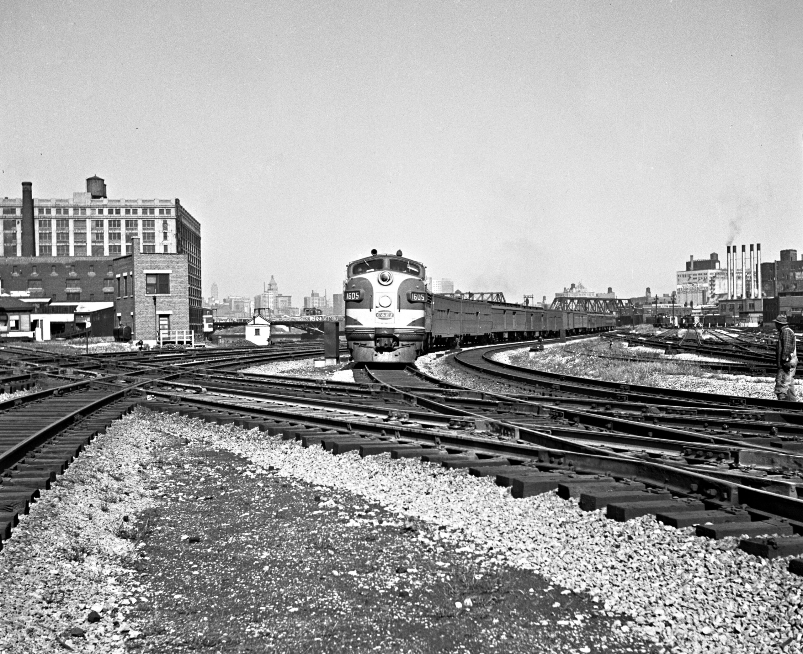
Chicago & Eastern Illinois handled the first leg of the the Dixie Limited on its 30-hour run to Jacksonville, Florida, via the Louisville & Nashville and Atlantic Coast Line. It departed Dearborn Station at 2:30 p.m. and was due into Jacksonville at 9:40 p.m. the next evening. Abbey-01-127-005
3:00 p.m.
The Blue Bird
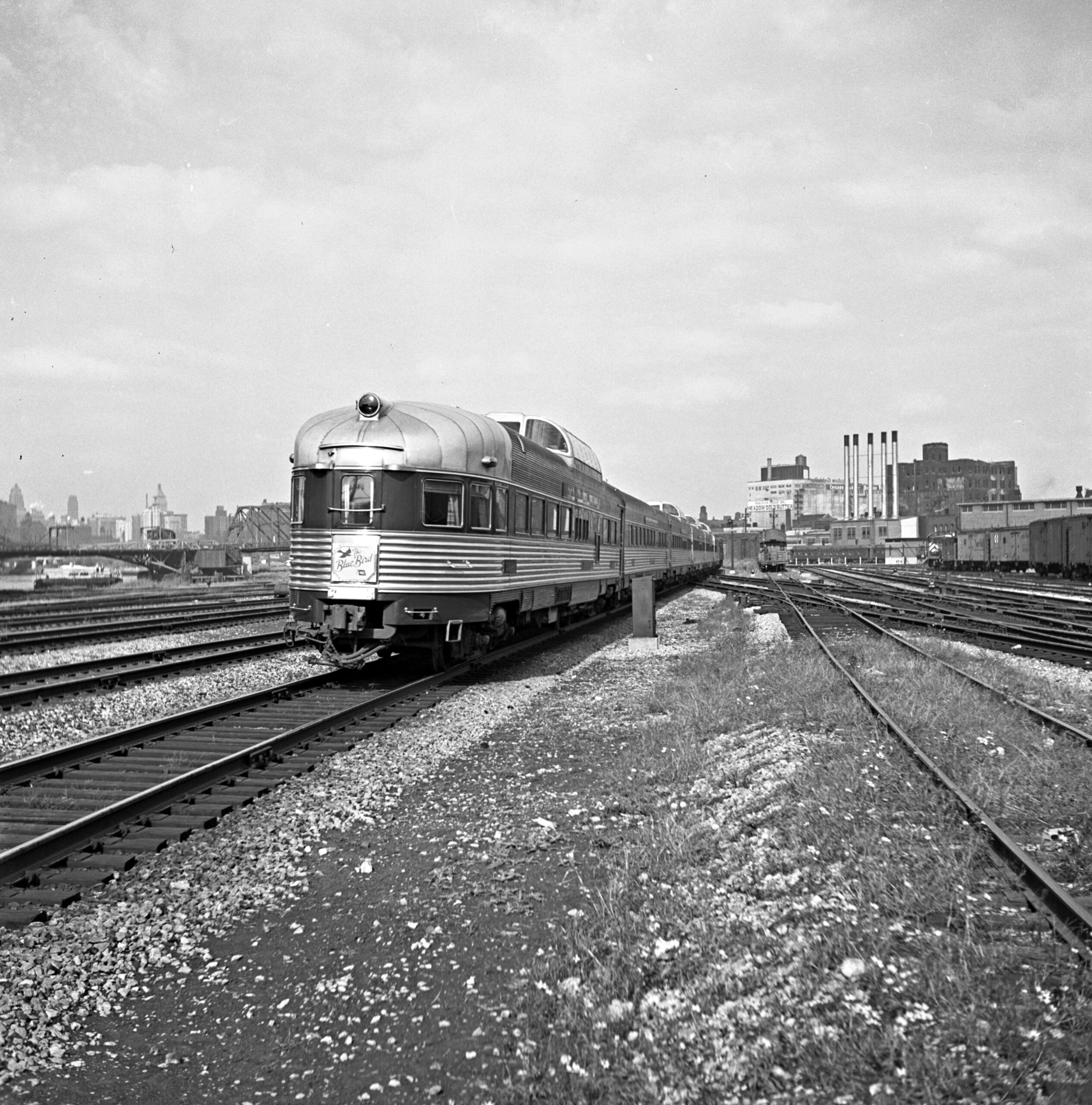
Wabash’s Blue Bird from St. Louis appears to be running a little late based on the sun angle of this photograph. It left at 8:55 a.m. and was due into Dearborn at 2:05 p.m. following its 286-mile run, but the shadows suggest the time was closer to 3:00 p.m. Abbey concluded his photography in the mid-afternoon on both days of the 1950 assignment at 21st Street, and this view of a round-end dome-observation car makes for a fitting end. Abbey-130-004
For more
The Wallace W. Abbey Collection came to the Center for Railroad Photography & Art as gift from the Abbey family in 2010. Trains magazine awarded us a $10,000 preservation grant to assist with efforts to organize and safeguard the collection (of more than 30,000 photographs) and make it available to the public.